A natural history notebook and joint project of the Missouri Botanical Garden, the Ecological Health Network, and the Restoration Ecology Lab at Virginia Tech.
Ricardo Viani is a professor at the Universidade Federal de São Carlos, Brazil, where he coordinates the LASPEF (viani@ufscar.br)
The Atlantic Forest in Brazil is a highly diverse tropical forest, listed as a global hotspot for biodiversity conservation. It is also the home of the two biggest Brazilian cities, São Paulo and Rio de Janeiro, and it is where most Brazilians live; around 150 million people inhabit and depend on the Atlantic Forest for the provision of ecosystem services.
Originally covering about 1.2 million square kilometers (297 million acres), the Atlantic Forest now covers less than 20% of its original area because of centuries of degradation. It is no wonder that the Atlantic Forest stands out globally as a region where forest restoration is urgently needed and is being taken seriously. In recent decades, many large-scale Atlantic Forest restoration programs have been implemented and, in 2009, the Pacto (Atlantic Forest Restoration Pact), a coalition of hundreds of institutions working for Atlantic Forest restoration, was launched. For its work, the Pacto was recognized as a World Restoration Flagship by the United Nations Decade on Ecosystem Restoration, highlighting it as a global example of an ongoing, large-scale, and long-term ecosystem restoration effort.
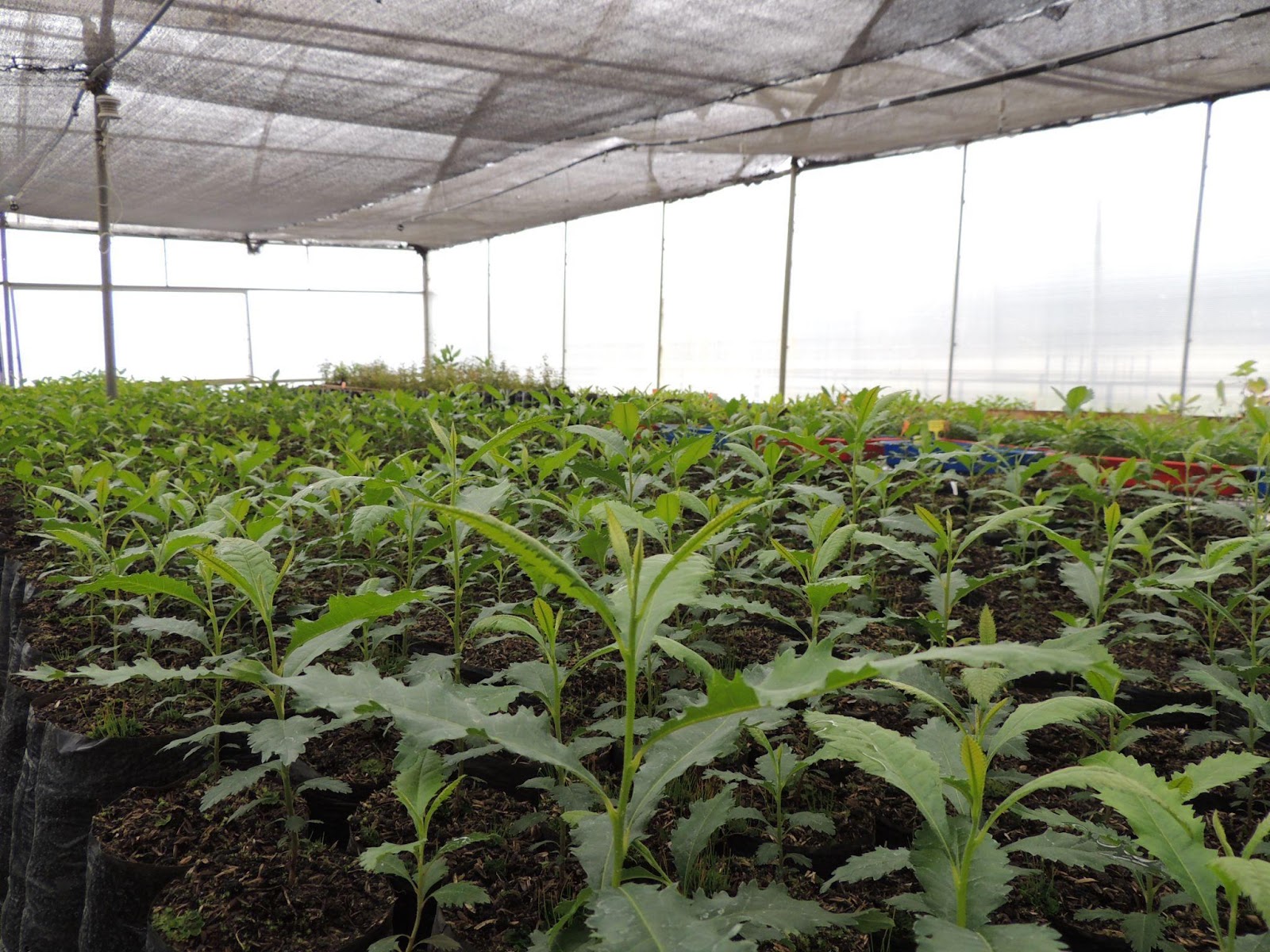
Landscapes where forest restoration plantings are usually done in the Atlantic Forest in Brazil. A sugarcane plantation (left, photo: Paulo Molin) and a pasture matrix (right, photo: Ricardo Viani), with variable levels of scattered remaining forest.
After decades of Atlantic Forest restoration efforts, it is time to evaluate what we have done so far, not only to assess the outcomes but also to inform other large-scale restoration initiatives worldwide. Thus, we recently investigated which tree species were included in 1,073 forest restoration plantings implemented from 2002 to 2018 in the Brazilian Atlantic Forest by restoration programs carried out by the NGO SOS Mata Atlântica.
Overall, 423 tree species were included in the evaluated plantings, which represent less than 8% of the Atlantic Forest tree flora. In comparison with remaining forest patches, restoration plantings skewed towards nitrogen-fixing, non-animal-dispersed, and pioneer species. Plantings had poorly included endangered and endemic species as well as species that were previously indicated as priority for restoration based on their ecological interactions, carbon storage, and conservation values.
However, the more striking result is that restoration initiatives are planting the same set of limited tree species across the whole Atlantic Forest. Although the Atlantic Forest has three types of forests (the Araucaria Forest, the Rainforest, and the Seasonal Forest), each one with their own singular floristics, restoration plantings are overall more similar in species composition to each other than to the remnants of the type of forest of the region where they exist. In other words, we plant the same species without considering spatial variation in local and regional floras.
This pattern raises an uncomfortable question. Is large-scale restoration via tree planting contributing to biotic homogenization, that is, the tendency for distinct places to become more similar?
A tropical forest restoration planting in the Atlantic Forest in Brazil. Plantings tend to be done with a similar set of species across the whole Atlantic Forest. Photo: Ricardo Viani
Why should we pay attention to the trees we plant for tropical forest restoration?
One may say that our role in tropical forest restoration is to trigger ecological succession, and it is not relevant if we plant just a few tree species across a wide, diverse region. Actually, some argue that we should plant the same species everywhere, by selecting and planting the best species to accelerate early forest development . This is one explanation for the overrepresentation of pioneer trees in restoration plantings, and a reason to increase the representation of generalist animal-dispersed trees, which attract native fauna to restoration sites and favor natural regeneration under planted trees. Another argument may be that evaluating what we plant for forest restoration is not so important because non-planted species will naturally colonize planting sites later on and change their floristic composition. However, this statement and the previous one are acceptable only if regional tree species can colonize restoration sites in fragmented landscapes – a questionable premise in typical landscapes of southeastern Brazil.
The few studies available in rich tropical forests show that many non-planted trees species colonize restoration plantings, which is good news. However, some functional groups, such as slow-growing tree species dispersed by gravity or by larger animals tend to be bad colonizers, especially in fragmented or defaunated landscapes. In other words, if they are not planted, many tree species will not reach restoration sites on their own, and we should pay more attention to their inclusion in restoration plantings.
Finally, we need also to consider that restoration is a strategy to promote in situ tree species conservation. The Atlantic Forest has more than 4,000 native tree species, almost half of them endemic, and dozens threatened by extinction. However, few endemic and threatened tree species are included in restoration plantings and some of the ones that are included are only used infrequently and in low abundance. Probably, some of them are also rare, absent in fragmented landscapes, and not good colonizers, which increases the importance of their planned and careful inclusion in restoration efforts.
A practitioner planting a slow-growing tree in the understory of previously planted pioneer trees. This is part of an experiment in the Atlantic Forest in Brazil, aiming to answer when it is better to plant slow-growing species: together with pioneer trees or under their shade. Photo: Ricardo Viani
The way forward
Restoration initiatives have done great work for the Atlantic Forest in recent decades, but there are always points that could be improved, such as the representation of regional flora and of some groups of species currently underrepresented in plantings (e.g., animal-dispersed, endangered, high value species for conservation, etc.). Solving this issue involves much more than just recommending their inclusion in restoration initiatives. Many of these species are rare, lots of them do not have seeds or seedlings available for restoration and, many, if not most, are slow-growing trees. Knowing how restoration practitioners perceive the importance of species diversity, selection, and composition for restoration plantings and potential trade-offs in prioritizing diversity representation versus fast early recovery may give insights on strategies to overcome this challenge.
In addition, as many underrepresented species in tropical forest restoration plantings are slow-growing, it is worth studying ways of introducing these species in restoration plantings. For instance, should we plant slow-growing trees under full-sun or under the canopy of previously planted pioneer trees? How can we balance the composition of restoration plantings to include slow-growing species without losing the benefits of rapid forest development promoted by fast-growing species? All these questions are still to be answered and part of my ongoing research project Optimizing high-diversity restoration: perceptions and approaches to add tree diversity in tropical forest restoration plantings.
We are on our way, but there is still a long path to go before restoration will truly represent the diversity of complex and unique biomes.
Part of an Atlantic Forest restoration experiment in Brazil where different abundances of fast and slow-growing species are being assessed aiming to find the best strategy to add slow-growing trees in tropical forest restoration plantings. Photo: Paulo Molin
Eve Allen, Program Director for the Northeast Bioregion, James Aronson, President of the Ecological Health Network, and Sefra Alexandra, Director of The Ecotype Project, share insights and outcomes from the inaugural workshop held at the Oak Spring Garden Foundation in Upperville, VA. This workshop led to the launch of a new coalition supporting initiatives for sustainable ecosystem and landscape restoration in the Eastern United States.
Unprecedented federal and state-level investments, combined with growing environmental education programs and awareness, are increasing the demand for ecological restoration (ER) and allied activities in the US, Canada, and worldwide. This is causing a demand surge for native seed and plant material across the United States. Similar trends are coming to light in many other parts of the world as well.
In January 2023, the National Academies of Sciences, Engineering, and Medicine released a 228-page report that found the country’s current supply of native seeds is already insufficient to meet the restoration needs of agencies like the US Forest Service and the Bureau of Land Management (BLM), and the situation is even more acute in the states east of the Mississippi River.
The skewed distribution of federal land ownership in the US exacerbates this problem. To wit, the US Government owns about 46% of the land in the 11 contiguous Western states, whereas its ownership averages only 4.6% in the remaining mainland states. Given that the US government is the primary purchaser of seed and plant material nationally, for use in restoration programs on public lands, this demand serves as a strong signal for farmers and nursery professionals to ramp up production. Despite this, a notable procurement gap exists in the Eastern states, where land ownership is predominantly divided among state governments and private individuals, hindering the development and expansion of robust seed and plant material supply chains.
In 2018, a survey of 760 respondents across the Eastern US states undertaken by the Mid-Atlantic Regional Seed Bank and the University of Maryland indicated that seed buyers sourced seeds from vendors located an average of 418 miles (673 km) away from their restoration sites (typically from vendors in the Upper Midwest (Tangren, Toth, and Siegel 2022). We conclude that there is an urgent need to build stronger networks in the Eastern US to increase supply chain capacity and to improve the quantity and quality of genetically and ecologically adapted seeds and nursery-grown plants with verified provenances.
The Northeast Seed Network
To this end, in March 2023, the Native Plant Trust, Ecological Health Network, and other partners launched the Northeast Seed Network (NSN) to reinforce and build connections and trust among government agencies, Tribal Nations, educational institutions, citizen groups, farmers, nurseries, other private companies, and nonprofit organizations including botanic gardens, seedbanks, and arboreta. By fostering collaboration among all these diverse stakeholders, the NSN seeks to facilitate knowledge exchange, promote impactful research, and advocate for the adoption of best practices, thus fostering a vibrant community of practice. Building strong private, public, and nonprofit partnerships is essential for building seed supply chain capacity or the ability to ensure that we have “the right seed [or plant], in the right place, at the right time” (Oldfield and Olwell 2015). This is because there are numerous ‘public good’ aspects of the ‘supply chain’ (e.g., R&D, education, demonstration, and advocacy) that will not be supported solely through market mechanisms.
New York ironweed (Vernonia noveboracensis), an important host plant to pollinators including the Eastern Tiger Swallowtail Butterfly (Papilio glaucus), is commonly used in ecological landscaping in the US Northeast Region. Credit: Sefra Alexandra.
Recognizing the Role of Botanic Gardens
To gather more information prior to undertaking any major new steps, the Ecological Health Network carried out a social network analysis to understand existing relationship patterns among the seed supply and demand chain actors in the Northeast US (Allen et al., under review). The study’s findings align with those of Tangren, Toth, and Siegel (2022), indicating that Midwestern seed vendors predominantly dominate markets in the Eastern US. For instance, a seed vendor based in Minnesota has established connections with over 94% of the end-users of native seed and plant material in the US Northeast identified in the study.
However, the research also unveiled that producers of seed and plant materials within the US Northeast region enjoy well-established social ties with many botanic gardens, arboreta, seed banks (referred to as botanic gardens hereafter), and educational institutions in the region. These results support the argument that botanic gardens are uniquely positioned to play an essential role in ecological restoration science and practice (Hardwick et al. 2011), especially in their own regions. Botanic gardens have expertise in numerous relevant fields, including plant taxonomy, horticulture, genetics, seed science, and environmental education, as well as knowledge from ecological field research being undertaken by a growing number of botanic gardens around the world (Aronson et al. 2014; Miller et al. 2016). Furthermore, as emphasized by Crane (2022), botanical gardens share the obligation of addressing socio-ecological challenges arising from climate change, alterations in land cover, and pollution. They must actively maintain their relevance through engagement, education, and tangible actions, particularly at the local level, outside the confines of their garden walls.
Indeed, many botanic gardens across the Northeastern and Northern Mid-Atlantic USA region have programs and activities aimed at strengthening native seed and plant material supply chains, among other things. For example, the Highstead Foundation in Redding, Connecticut, is deeply involved in sustainably harvesting seeds from local, naturally occurring plant populations. Following this, the staff meticulously cleans and stratifies the seeds before growing them into plugs. Local farmers, such as those affiliated with the Northeast Seed Collective will then proceed to amplify the plant material to produce the specialty crop of ecotypic seed. (Read more here).
In Hockessin, Delaware, Mt. Cuba Center, a botanic garden dedicated to preserving native plants and ecosystems across the Mid-Atlantic and Eastern Temperate Forest Region, conducts trial garden studies aimed at evaluating native species for their horticultural and ecological value. These studies serve to educate the public about the garden performance and ecosystem services provided by native species while also fostering the development of new markets for regionally produced seed and plant materials. The garden evaluates material and, where appropriate, shares material for local native plant nursery production. Beyond the horticultural side of the trade, Mt. Cuba engages with land managers and restoration growers, working to understand needs and promote local provenance workhorse species in collaboration with others in a mid-Atlantic seed users network.
Native Plant Trust’s Nasami Farm in Whately, Massachusetts, Nasami Farm, has a longstanding practice of cultivating native plant material from hand-collected wild seeds. More recently, they have expanded their efforts by establishing seed increase plots to enhance production capacity for regional restoration projects.
These examples provide a sampler of the valuable contributions that botanic gardens across the region are already making to native seed and plant supply chains. However, in May 2023, Eve Allen and James Aronson, alongside Christopher Dunn, the Director of the Cornell Botanic Gardens, recognized a need to improve communication about these existing activities, and programs through improved networking among botanic gardens at a bioregional level.
Eve Allen, from the Ecological Health Network (EHN), and Todd Bittner, Director of Natural Areas at Cornell Botanic Gardens, discussing the Native Lawn Demonstration Area during the EHN Site visit in the fall of 2022. Photo Credit: James Aronson.Least trillium (Trillium pusillum) in bloom at the Mt. Cuba Center, a botanical garden in Delaware dedicated to preserving native plants and their ecosystems across the Mid-Atlantic and Eastern Temperate Forest Region. On the right, Eve Allen of the Ecological Health Network (EHN) stands with Élan Alford, Plant Conservation Scientist, and Jeff Downing, Executive Director of the Mt. Cuba Center, during an EHN site visit in the spring of 2023. Photo Credit: James Aronson.
Over the course of a long day and delightful evening, the participants worked together to chart a course for a new collaborative effort. Together, we recognized the distinctive responsibility botanical gardens bear to strengthen native seed and plant supply chains for landscape restoration across a spectrum of ecosystems, spanning from urban areas to suburbs, agricultural landscapes, corridors, and other protected areas of significant conservation value. More broadly, we agreed that botanic gardens are custodians of our shared plant biodiversity on our planet. By engaging in conservation, exploration, education, research, providing facilities, and leveraging expert horticultural know-how, they – and allied organizations like arboreta, herbaria, and seedbanks, should work together to bolster resilience and restore the health of people, ecosystems and landscapes. We also agreed that it would be timely to work on meeting this challenge at a bioregional level, namely in the Eastern US.
Enhancing demand signals by building better markets
The National Academies Report identifies unpredictable demand as the foremost challenge for native seed suppliers across the United States (p.98). This problem is especially pronounced in the US Northeast, as the substantial increase in demand for native seeds and plants fails to translate into intelligible markets. Current and potential suppliers within the Northeast Seed Network, including farmers and nursery professionals poised to expand their production of diverse species and ecotypes, require more consistent and transparent signals of demand.
As such, a primary objective of the Restorative Landscape Coalition is to address and surmount the various policy, regulatory, and cultural obstacles hindering the utilization of source-identified, genetically diverse seed supplies, as well as nursery-grown or propagated plant materials. For example, we addressed the necessity of conducting targeted outreach and engagement with state and municipal agencies to facilitate the development of enhanced recommended species and species substitution lists. Currently, these lists predominantly feature mid-western species, likely due to their commercial availability.
Rather than solely focusing on seed production or amplification efforts, we recognize the critical importance of fortifying the ‘demand’ side of seed and plant material supply and demand chains. This strategic emphasis not only elucidates the distinction between the Restorative Landscape Coalition and the Northeast Seed Network but also underscores their mutually reinforcing relationship. Our approach involves generating and sharing knowledge, know-how, and best practices to enhance existing markets and create new markets for high quality seed and plant material.
Leverage our living collections to amplify seed production
Citing The National Academies of Science’s 2023 report, we reaffirmed how the in situ living collections (particularly conservation collections of wild origin) housed in botanic gardens and affiliated non-profit organizations serve as a crucial safeguard for native species within the plant materials development pipeline, when reproductively isolated from other related collections, for seed amplification.
The US National Seed Strategy and National Academies of Sciences report emphasizes the imperative to increase collaboration and cooperation across agencies and with external partners. This involves sharing expertise, facilities, and optimizing the production and use of plant materials. Botanic gardens are custodians of our shared plant biodiversity. By engaging in conservation, education, research, providing facilities, and leveraging expert horticultural know-how, we are committed to providing a key link in efforts to bolster resilience and restore the health of landscapes in the Eastern US.
In the Apple Room, our workshop proved not only enjoyable but remarkably productive. As the day drew to a close, participants reached a consensus on the crucial role of botanical gardens in tackling socio-ecological challenges stemming from climate change, land cover change, and pollution. Photo Credit: Sefra Alexandra. As the evening drew to a close, together, we affirmed the unique responsibility botanical gardens bear in bolstering native seed and plant supply chains for landscape restoration. It was underscored that our institutions must actively assert our relevance through tangible actions, particularly at the local level, extending beyond the confines of our garden walls—a sentiment eloquently highlighted by Peter Crane, Director of the Oak Spring Garden Foundation, in his insightful 2022 opinion piece, Botanic gardens: Seizing the moment while imagining the future in Plants People Planet. Photo Credit: Oak Spring Garden Foundation.
Fostering bioregional collaboration to achieve lasting social-ecological impact
To advance the individual and collective missions and visions of the organizations and institutions participating in the Restorative Landscape Coalition, we will strive for a holistic perspective and approach that emphasizes the tremendous power and potential held within the concept of a bioregion. This is a spatial scale often overlooked by public, private, and government institutions. Note that a bioregion is not defined by political boundaries nor even by ecological and biogeographical boundaries alone. Rather, the concept corresponds to the geographical territories of human communities and cultural groups as well as the ecological systems on which they depend and of which they are a part. To be coherent, and useful, the boundaries of a bioregion must be delineated to uphold the integrity of its biological and human communities, ecosystems, and social-ecological systems. This includes preserving essential processes such as nutrient cycling, historical disturbance regimes, and species migration, among other biological and ecological factors. Additionally, sustainable and equitable management of resources and ecosystem services is vital, spanning generational and community boundaries within the diverse human populations inhabiting a bioregion. Bioregions vary in scale, ranging from watersheds to much larger territories, and may traverse international borders. However, they are fundamentally shaped by their flora, fauna, and human communities, each contributing to and benefiting from a distinctive identity defined by climatic, ecological, and cultural characteristics (Berg 1991).
While initially complex and possibly daunting, there are significant advantages to the approach of organizing human activities and systems based on bioregional boundaries. Most importantly, it provides a strategic framework for connecting individual and collective efforts to facilitate impactful changes at appropriate scales to address biodiversity and climate goals (Pezzoli, 2015; Wearne et al., 2023). That being said, addressing the intricate environmental challenges of the 21st century on a large spatial scale, especially with an unconventional concept like bioregionalism, demands innovative forms of network governance (Scarlett and McKinney, 2016).
Left photo: Beds holding tree saplings for reforestation projects, including urban tree planting initiatives, in the Mid-Atlantic region. Right Photo: cleaned seeds of Arrow Wood Viburnum(Viburnum dentatum) at Pinelands Nursery in New Jersey. EHN Site Visit, Summer of 2022. Photo Credit: Eve Allen.
Social impact and Social-ecological impact networks
A social impact network is one in which formal and informal institutions collaborate across diverse interests, sectors, and political arrangements to establish social norms, social capital, and trust that together can propel and sustain collective information sharing, decision-making, and action (Kapucu and Hu 2020; Ehrlichman 2021). However, when social-impact networks are operating at broader geographical and societal levels – bioregions – and developing initiatives that target ecological and environmental challenges that demand integrated ecological and social interventions, we may call them social-ecological impact networks (Ecological Health Network 2024).
The Restorative Landscape Coalition is intended to be a social-ecological impact network dedicated to working with and enhancing the capacity and impact of the Northeast Seed Network and other seed production-focused partnerships, as well as emerging, restoration- and conservation-oriented partnerships operating across the Eastern US. Our commitment is to support initiatives that sustain, conserve, and, when necessary, restore degraded ecosystems and reintegrate fragmented landscapes within our bioregion – the overlapping and adjacent EPA Level III Ecoregions of the US Northeast, Mid-Atlantic, and Southeast regions. Please note that here we use the ecological definition of “landscape,” namely an assemblage of ecosystems that are arranged in recognizable patterns and that exchange organisms and materials such as nutrients and water (Forman & Godron 1986).
While acknowledging the substantial work ahead, we are confident that the collective resources within our institutions, organizations, and like-minded networks will allow us to make inroads toward our shared goals. Collectively, we embrace an unwavering dedication to the public good and the well-being of future generations. Our shared missions encompass inspiring meaningful connections among people, plants, and the natural world, education and awareness, conservation and stewardship, and research and innovation, all aimed at enhancing society’s overall well-being, resilience to global changes, vigor, and – in a word – health.
Please join the Restorative Landscape Coalition at the American Public Gardens Association’s Annual Meeting in Boston, June 24 to 27, 2024. We will be there, hosting a 90-minute workshop entitled Fostering regional collaboration among public gardens to address native seed and plant material needs, on Thursday, June 27th, from 10:30 a.m. to 12:00 p.m.
To stay in touch and receive updates about the Restorative Landscape Coalition and the Northeast Seed Network, please sign up for our mailing list. You can also follow us at @ecohealthglobal on Instagram, @EcoHealthNet on X and Facebook, and Ecological Health Network on LinkedIn for updates.
James Faupel is the urban ecology restoration supervisor at the Litzsinger Road Ecology Center (LREC) and Caity Sims is the Project Clear restoration coordinator. The LREC is a private, urban outdoor education site in the heart of Metropolitan St. Louis, Missouri that is managed by the Missouri Botanical Garden for educational programming with K-12 teachers and students, and supported by many local university-based researchers.
Part 1: by James Faupel
Anticipating Loss
In September of 2018, when I took on the lead restoration ecologist role at the Litzsinger Road Ecology Center (LREC), I was aware of the impending utility pipeline project (Project Clear) that would impact around a quarter of this education center’s restored habitats and the adjoining urban Deer Creek. The 15.8-hectare (39-acre) ecology center combines a mix of reconstructed bottomland prairie and restored riparian woodlands, with a stretch of urban creek in surprisingly good ecological condition. I knew this was a unique opportunity to set up a long-term study to examine the processes of reconstructing tallgrass prairie following major anthropogenic soil and landscape disturbance, a topic with little previous research, especially in urban areas.
The 6.3 km (3.9 mile) long Deer Creek branch of Project Clear was slated to dissect a 0.8 km (0.5 mile) long swath of LREC’s restored habitats – a pretty significant amount of collateral damage. To be clear, the purpose behind Project Clear’s sanitary pipeline path is well intentioned. The Metropolitan St. Louis Sewer District’s (MSD) Project Clear is a six billion dollar, 28-year long initiative to improve water quality and alleviate many wastewater concerns related to the frequent sewage overflows of the legacy sewer system of the St. Louis region. Cleaner water in Deer Creek would mean healthier breeding and feeding conditions for a wide variety of wildlife that live in or rely on the water of the creek, as well as healthier adjoining ecosystems, and much healthier domestic water supplies for human residents of St Louis County. The collateral damage of the MSD Deer Creek branch was 6.3 km (3.9 mile) of riparian habitat was damaged, degraded or destroyed.
In 2019, the Litzsinger Road Ecology Center (LREC)’s oldest prairie reconstruction and woodlands were dissected by the Project Clear pipeline path. The LREC is an outdoor educational facility of the Missouri Botanical Garden, and relies on functional ecosystem services to introduce children to the intricacies of nature. The pipeline project construction equipment would directly impact the LREC’s grounds and classes for three years, but its impact to the habitats here will be felt for generations. Photo by James Faupel.
As discussed in a previous NHER blog post on the topic, urban prairie reconstructions are important tools in the toolbox of prairie education to the general public and in saving North America’s prairie remnants. Remnant prairies are invaluable fragments of a once vast grassland ecosystem of the Midwest and are now one of the most endangered ecosystems in the world. Getting the chance to expand the area covered by reconstructed prairie at an educational site like LREC was an opportunity that I did not want to miss. The downside was that the LREC restoration team would have only one year to gather baseline data before the sanitary pipeline construction began, and I also had to fit in learning all of the other ins and outs of my new role.
Throughout 2019, with the assistance of LREC volunteers, interns, and partner researchers from local universities and organizations, we were able to gather a wide array of baseline data that could be used as a comparison in the years ahead, once the future restored prairies are older. In 2019, the previously restored habitats at LREC were 30 years old, among some of the oldest restored habitats in the St. Louis region. Restoration projects of this age are incredibly valuable for ecological research projects looking to better understand anthropogenic impacts on the environment around urban centers and to learn best practices for effective, long-lasting restoration efforts. They are priceless.
During the growing season of 2019, we were able to survey all the vascular and nonvascular plant species growing in the proposed pipeline path and adjoining areas, as well as survey for birds, bees, spiders, ants, and algae thanks to the varied expertise of all involved. Baseline samples were collected of the upper soil horizons along the entire pipeline path, in addition to a complete inventory of all of the trees and shrubs that would be removed during construction so we could assess their value. The most significant baseline dataset is that of Elizabeth Hasenmueller and her Lab at Saint Louis University, who had been studying the water quality of Deer Creek at LREC for five years prior to the sanitary pipeline installation and are excited to continue this research, hoping to capture more data and test hypotheses concerning the hydrology and geochemistry of this urban stream as water quality improves with the removal of the sewage overflows from the creek.
LREC volunteers assisted staff in a tree inventory of 746 native trees and shrubs ahead of the pipeline installation in 2019. The canopy trees were measured and their value assessed using the US Forest Service’s iTree database. The USFS’s estimated replacement value of the 289 mature canopy trees was half a million US dollars. This dollar value is in addition to the countless ways the ecological and environmental services provided by these trees could be valued. Photo by James Faupel.
Deconstruction of Habitat
On September 30th, 2019, construction vehicles arrived on the grounds of LREC, and began the month-long habitat removal on site. In what felt like the blink of an eye, a large section of one of the oldest prairie reconstructions in the St. Louis region, along with 746 individual native trees and shrubs, were gone and no longer providing any ecological or educational services. It was quick, like a bandage being ripped from the skin.
Before and after the 0.8 km (0.5 mile) MSD pipeline construction path on the property of the LREC. Left: October 2018. Right: August 2020 (Google Earth 2019, 2021).
The pipeline installation process, from start to finish on LREC property, lasted nearly three years. Following the removal of all the preexisting habitat, work began on trenching the ground open, dynamiting the bedrock, installing the sewer pipe, reworking the now homogenized limestone bedrock/C horizon soil mix back into the trenches, restabilizing the streambanks from their stream crossings, and finally grading the soil out to pre-construction elevations. We knew from the beginning of their trenching process that we would ultimately be trying to grow native prairie plants in a “novel ecosystem” with soil conditions that would never co-occur with them in nature.
Throughout the construction process, there was plenty of time for planning how we would restore the land once it came back into our hands, as well as how we would monitor it long term. There is little research that has been done on the topic of prairie reconstruction following major anthropogenic soil disturbance. Initially we thought it would be beneficial to test many different methods of soil remediation ahead of the seeding of native prairie plants in different study plots. However, during the three year construction period, there were several major flooding events from the adjacent Deer Creek that changed our minds. The regularity and increasing frequency of these flash flood events of this urban creek made us take pause and the aforementioned research idea was scrapped. These events aren’t likely to lessen anytime soon, as the area covered by impervious surfaces in the surrounding watershed continues to grow. Future flooding events would introduce too many confounding variables to any kind of research that compared the outcomes of various soil remediation methods to make it a worthwhile investment of our time and resources.
Left: Throughout the construction of the pipeline path (2019-2022), the path was impacted by Deer Creek flooding beyond its banks 11 times. It was completely covered by 4 major flash flood events as seen here. Right: The pipeline path a few months after construction had finished in late summer of 2022, covered in a growing season’s worth of early successional species. Here a contractor puts down the first annual cover crop to help break up the compacted soils and help hold the soil in place during rain events. Photos by James Faupel.
In late summer of 2022, the property was handed back to the staff at LREC to begin the habitat reconstruction work. By this point in time, I had been promoted to a supervisor position at LREC and had many more responsibilities that took me away from being able to dedicate significant time to the Project Clear pipeline restoration project. Our two summer interns that year assisted with the second round of soil sampling for comparison to the baseline soil data and an inventory of all of the plants that naturally colonized the disturbed areas along the entirety of the pipeline path that year. For information from that botanical inventory, you can read our article that was published in the 2022 volume of Missouriensis. Our immediate reconstruction plans were to bring in a contractor that could quickly get annual cover crops down and hopefully germinate and root into the compacted soil before any fall or winter flooding events occurred. We also planned for a major seed collecting effort in 2023, so that we could sow a wide variety of early successional native species onto the pipeline path in late fall of 2023, or before the first snow of winter.
With my role having been redirected away from the pipeline path reconstruction, I lobbied for a new staff member that could replace me and focus all their efforts on the reconstruction, research, and monitoring of this important project. Caity Sims was hired for the role of coordinator of the project in January of 2023 and hit the ground running. It has been an incredible year mentoring her throughout this process and I look forward to exploring the reconstructed prairie habitat she will be establishing and chaperoning with our amazing team of volunteers, staff, and interns over the next few years.
Part 2: by Caity Sims
Before Reconstruction Began
I was fortunate enough to witness the LREC before Project Clear as a summer intern in 2019. That summer, I assisted with collecting pre-deconstruction baseline data on trees and the algae found in Deer Creek. After my internship, I left St. Louis for Jonesboro, Arkansas to earn a master’s degree focused on botany in the Mississippi Alluvial Plain. Ready to apply my botanical and research skills in the working world, I returned to the LREC in January 2023 as the Project Clear restoration coordinator. I was shocked to finally see first-hand the impact the pipeline construction project had had on the riparian, woodland, and prairie ecosystems of LREC. What seemed in my memory like a maze of bottomland woodland was reduced to a scanty wooded edge surrounded by a sparsely vegetated brown strip of fallow land.
Before I joined the LREC team, a cover crop of common wheat (Triticum aestivum) had been seeded onto a majority of the pipeline path in winter 2022. Around the same time, a six-species cover crop mix, consisting of crop grasses, common pea, and field mustard (Brassica rapa) was seeded onto the southern section of the path. Cover crops mend the soil by adding nutrients, perforating the soil for better water infiltration, outcompeting weedy species, and preventing erosion of bare soil.
Unfortunately, the first round of cover crop mixes did not do well, and by mid-April the common wheat was barely a foot tall and had already gone to seed. The mixed species cover crop did not grow on most of the seeded area of the southern section due to flooding washing away a majority of the seeds. The path desperately needed a second cover crop at that point, so we hired contractors to seed the warm season crop, Sudan grass (Sorghum bicolor), onto the majority of the path again and a nine species cover crop mix onto the southern section. The Sudan grass did much better, growing to heights of over six feet in some areas. Although the mixed species cover crop seemed to do better, the extreme summer heat drying out the compacted soils resulted in depauperate mature plants. There were many areas directly over the pipeline that seemed unlikely to hold any vegetation at all.
Cover crop comparison between common wheat, taken on May 23, 2023 (A) and Sudan grass taken on August 3, 2023 (B); both photos were taken from about the same position on the path, but facing in opposite directions. Pictured in panel C are size comparisons of common wheat individuals on May 26, 2023, the two on the left were collected from the middle of the pipeline and the one on the right from the outer edge of the pipeline path. Note the numerous bare patches of soil in panels A and C. Photos: Caity Sims.
Despite environmental conditions being heavily anthropogenically impacted, a good number of native early successional and bottomland species grew alongside the cover crops on the path. I was surrounded by many familiar disturbance-prone and riparian species, as my master’s thesis had focused on plants growing on Mississippi River islands. I recorded 310 species growing on the entire path after completing vegetation surveys in 2023. As I expected, some of the most common species were yellow foxtail grass (Setaria pumila), southern crabgrass (Digitaria ciliaris), barnyard grass (Echinochloa crusgalliand E. muricata), hairy seed crowngrass (Paspalum pubiflorum), late boneset (Eupatorium serotinum), and tall goldenrod (Solidago altissima), all of which thrive in disturbed environments.
As I work toward reconstructing the land to improve structure and function of the ecosystem for many native organisms, I need to quantify the results of this effort. To measure the changes in plant communities along the pipeline path over time, I established dozens of permanent vegetation monitoring plots along the path that will be monitored every summer. For each plot, I collect the presence and percent cover of each species in the plot. I am hopeful that by 2027, native prairie plants will constitute 75% of the flora and vegetation in every plot.
Summer interns, Karen (left) and Cicely (right), learning to identify plants from a vegetation monitoring plot on the pipeline path. Photo: Adam Rembert.
Also found post-pipeline construction were two species new to Missouri: Centaurium pulchellum, and Myosotis arvensis, and three new to St. Louis County records: Sesamum indicum, Cyclospermum leptophyllum, and Krigia cespitosa. All record species are not native to Missouri except K. cespitosa, which has been recorded from neighboring counties. It’s not uncommon to find new state or county records in disturbed areas. For more detailed information about those species, their identification, and potential explanations for their introduction to the LREC, check out my article in the 2023 volume of Missouriensis.
We have classified several different habitat types on the pipeline path including wet depressions and ephemeral ponds, rocky upland (i.e., “glade”), creek bank, woodland edge, and fallow ground. Due to a permanent pipeline access easement built and maintained by the Metropolitan St. Louis Sewer District (MSD), we cannot reconstruct the bottomland woodland that was destroyed. However, we can reconstruct a bottomland prairie on a majority of the path where the fallow ground with rocky and compacted soil are the most prominent. In the wider southern section, we will reconstruct a savanna that will include tree plantings outside of the MSD’s easement.
Going Forward
Staff and volunteers collected seed throughout the 2023 growing season. We focused on collecting species with Coefficient of Conservatism (C-Value) ranks of six or below, which is consistent with the range of C-values observed in the 2022 vegetation survey of the path. The coefficient of conservatism (or C-scores) is an index ranging from 0-10, representing a species’ fidelity to intact remnant or long-restored habitats, as determined by local botanical experts. Species with higher C-scores are less tolerant of environmental degradation and increasingly restricted to high quality sites. Species with C-Values from 0-6 are likely to be found in disturbed and early successional environments, while species with C-Values from 7-10 are more likely to be found in near-pristine and remnant environments (Ladd and Thomas 2015). High C-Value species are harder to establish in restored and reconstructed habitats.
Summer and fall interns focused mainly on seed collection, cleaning, and organization to prepare for the 2023/2024 winter seeding. It was a monumental effort with amazing results. We collected seeds from 96 species in 2023 for a total weight of 49 kg (108 lbs) of mostly Pure Live Seed (PLS), with some chaff. In addition to collecting seeds, contractors have drilled 39 prairie species onto the pipeline path seeding a total of 16 kg (36 lbs) of PLS. We also added seeds collected in previous years that were housed in seed storage at the LREC. Including the 2023 collected seed, the PLS from contractors, and the previously collected seed, a total of 189 species with a total weight of 74 kg (164 lbs) was seeded on the pipeline path. To view the results of our seed collecting effort in 2023, please see our interns’ compiled end of season unpublished report.
Boxes of Culver’s root (Veronicastrumvirginicum) seed ready to be cleaned (A), fall intern, Cailyn, posing with seed to be added to the broadcasting mix (B), staff and volunteers mixing seed in preparation for broadcasting the pipeline path on January 5, 2024 (C), and staff and volunteers broadcasting the “glade” mix onto the most well-drained and rocky portion of the pipeline path on January 11, 2024 (D). Top photos by Adam Rembert, bottom photos by Caity Sims.
I am hopeful that the seedings will be successful and signs of a prairie will begin to emerge this year. However, flooding and poor soil conditions are major issues on the pipeline path. I have already dealt with the aftermath of floods washing away cover crops and soil, and remaining soils lacking suitable nutrients and structure for plant growth. These are out of my control, so all I can do is accept them, keep trying, have patience, and not let frustration get the best of me.
In three years, I anticipate less introduced and early successional species as they fail to compete with the maturing perennial natives. I envision more pollinator observations on the former pipeline path as the prairie species begin to bloom. After the third growing year, we may be able to burn the young prairie and savanna. In 30 years, I hope to return to see restored prairie, savanna, woodland, and creek habitats functioning as home to a diversity of plants, insects, birds, reptiles, amphibians, mammals, and microbiota like the undisturbed LREC habitats do today.
Staff and volunteers broadcasting a spring and summer flowering seed mix onto the pipeline path on October 13, 2023. Photo: Tom Kibby.
By: James Aronson, Daniel R. Pérez, and Adam T. Cross
Daniel Pérez is head of the Laboratory for Rehabilitation and Restoration of Arid and semi-arid Ecosystems (LARREA) at the Faculty of Environmental and Health Sciences, National University of Comahue, Argentina. He also leads two ecological restoration projects in arid northern Patagonia, the first being the one described here and also the one described in his 2021 NHER post here. In addition, Daniel was coordinator of the Argentinian national Network for Ecological Restoration (ENREA) and organizer of its 3rd Congress held last November. James Aronson and Adam Cross are both members of the Steering Committee of the Ecological Health Network. James is also an Emeritus Scientist of the Center for Conservation and Sustainable Development, MBG, and Adam is Adjunct Senior Research Fellow at Curtin University, Perth, Western Australia.
Straddling the Andes and the border between Argentina and Chile, an ancient ‘Lost World’-looking forest persists. It occurs in fragments, dominated by the extraordinary Gondwanan conifer Araucaria araucana, called Pehuén in the Mapuche Mapudungun language and widely known by that name today in southern South America. The name of this giant emergent (up to 80 m tall), and very long-lived (1500 years and more), fire resistant ‘living fossil’ tree, is evidently related to the Pehuenche, an ancient ethnic tribe of migratory hunters in south central Chile and adjacent Argentina, before the 16th century CE when Spanish colonists began to arrive and change the course of everything.
Forest fragment of Araucaria araucana (Pehuén) right in the town of Caviahue, with an understory of the southern South American bamboo, Chusquea culeou. Credit: Laura Abraham.
The Pehuenche were so named for their dependence on the seeds of the Pehuén as a food source. Between 1550 and 1850 CE, some of them migrated west and merged with other peoples of northern Patagonia, in a process described by historians as becoming Araucanized. In the 21st century these Peoples still retain rights to some of their ancestral lands in northern Patagonia, but just barely. Despite the name Mapuche, which means “people of the land”, their situation in modern day Argentina is truly precarious.
While the Pehuén forest is alive and well and regenerating in some large parks in Chile and Argentina, where livestock are excluded, the dominant species is considered critically endangered by the IUCN, and a poignant example of its vulnerability can be found around Caviahue (Roig et al. 2014).
Typical degraded Pehuén forest remnant near the shores of Lake Caviahue. Credit: Adam Cross.
Pehuén, the rather odd English common name of which is Monkey Puzzle Tree, is one of only two highly disjunct Araucariaceae representatives in southern South America. The other 18 extant species of this Gondwanan family all occur in the South Pacific region, in New Caledonia, eastern Australia, Papua New Guinea, and Norfolk Island.
In Caviahue, whose name most fittingly means “Sacred Place of Reunions”, there is an ambitious ecocultural restoration, rehabilitation, and transcultural sustainable development and educational program getting underway, centered on Pehuén(Pérez et al. 2020). The first activities began six years ago with tree plantations and restoration-based education. Since then, there have been countless meetings with all social sectors of Caviahue such as the Mapuche community elders, Caviahue-Copahue Provincial Park, the Caviahue Ski center, primary and high school principals, political decision-makers, and leaders of the tourism sector, all in search of a social consensus and support for the restoration project. This vocation to build common ideas through dialogue, respecting visions, expectations, and desires of the whole community, is one of the most notable features of the work program. It is partly inspired by the Mapuche name for the site. But, as yet there have been only very limited discussions between the dominant, Spanish speaking, sedentary Western community and the transhumant, Mapudungun-speaking Mapuche.
Transhumance – a disappearing way of life
Transhumance is a form of animal husbandry and pastoralism that is remarkably well-adapted to arid and semi-arid lands. The word derives from the Latin trans (beyond) and humus (land), and thus means ‘beyond the land of origin’. It involves biannual movements of flocks between high summer pastures and winter grazing grounds at lower altitudes, or vice versa. In some cases, the entire tribe or group moves with the herds, while in others, only the herders make the biannual trek. This way of life was once widespread, in drylands on most continents, but is now lost and almost forgotten in most places. In Neuquen Province it still survives among the Mapuche. They camp in their ancestral lands near Caviahue lake (1646 meters above sea level) during the warm months, and then during the cold months they and their mixed herds migrate to Huncal (1204 masl) approximately 100 km east and much drier in summer than Caviahue.
Typical Mapuche settler in transhumance, herding Neuquén Creole goats, a genotype especially well adapted to the region. Credit: Agustín Orejas.
Although there is a transhumance law in Neuquén that seeks to protect this ancestral practice, Mapuche farmers are often forced to travel along paved roads to reach their destinations because many fields have become the private property of the colonizers and are blocked in with wire fences.
The Caviahue site joined the Ecological Health Network in 2022 (see here), and a lot has happened since then. The first and third authors of this blog have been offering support to weave together a holistic, ecocultural approach with a focus on human health for the program. Numerous other colleagues in restoration science, and social sciences, from Argentina, Chile, Mexico and Brazil have started getting involved following a visit to the site led by Daniel Pérez of the 3rd Congress of the Argentinian National Ecological Restoration Network held last November, in Neuquén.
Field trip near Caviahue. Credit: Adam Cross.
The project was initiated with the goal of studying how to restore the Araucaria forest in Caviahue, one tree at a time. It is daunting because the trees grow very slowly and there is little previous research on similar species in xeric regions providing a template to build upon.
It has gradually become clear that the restoration of this ancient, isolated Araucaria forest must be ecocultural, and include ecological rehabilitation and landscape reintegration of the degraded grazing lands of the Mapuche pastoralists who camp with their herds of sheep, goats, cows and some horses at one end of Caviahue lake for 6 months of each year. Additionally, the town of Caviahue needs restorative work, because of the planting of invasive Pinus contorta from Western North America, which is escaping and naturalizing in a heritage landscape where this highly competitive conifer does not belong (see below).
Araucaria araucana emerging among a dense formation of invasive Pinus contortain the town of Caviahue. Credit: Laura Abraham.
At the same time, Daniel and his colleagues came to understand that a truly great context for ecocultural restoration exists here. Caviahue is an extremely interesting town of ca. 1000 permanent residents. There is a strong sense of community among the westerners, and a desire to keep the quiet, nature-based quality of their lifestyle in the town and its valley, despite the interest of many real estate developers to ‘grow’ the ski station and the town, with all its charming low-key tourism services into something much bigger. They are aware that the isolated, relictual population of Pehuén is of great cultural value, but they don’t necessarily see that something can be done to change the nature of the broadly degraded and fragmented landscape where only a few ancient trees remain with little evidence of regeneration. Such change can only come about through trust-building and cooperation with the Mapuche pastoralists.
If one visits the land of the Caviahue Ski centre, not far from the ski slopes, a spectacular remnant of primary-type Pehuén forest of a few hectares there reveals what the ancestral forest was like, and provides a reference model, at least for the more mesic sites in the valley, to those who would entertain the concepts and a project of ecological restoration.
Primary-type forest of Araucaria on the protected lands of the Caviahue Ski Center. Credit: Laura Abraham.
There, one can see the awe-inspiring, living fossil Pehuén trees towering over a thick understorey with Araucaria seedlings and saplings emerging from the deep humus, leaf litter, and topsoil, rather than bare rock and skeletal sands seen more generally in the area. Among the spectacular Pehuén are also seen stands of Antarctic Beech (Nothofagus antarctica), locally known as Ñire, and in the more humid places, the related Lenga (Nothofagus pumilio); both species belong to another Gondwanan genus often co-occurring with Araucariaceae (Peri et al. 2016; Veblen et al. 1996). These areas are in stark contrast to the heavily grazed forest remnants where the Nothofagus persist only as rare, isolated stands, the lower two meters or so of which are stripped bare of foliage (Martínez et al. 2023).
Ñire (Nothofagus anctarctica) on pedestal caused by massive loss of topsoil over many years due in part to over-browsing by goats and cattle. Credit: Daniel Pérez.
The impacts of tree-felling for timber, overgrazing, and resulting topsoil loss over most of the valley are clearly profound.
The species is listed in IUCN’s Appendix I – Threatened with extinction, trade only in exceptional circumstances. Elsewhere, in Lanin Park in Argentina, and Conguillo Park in Chile relatively large stands occur but here in Caviahue, its future depends on local people, of two highly contrasting cultures.
The Ecocultural Restoration Program led by LARREA at Caviahue will include both the Mapuche pastoralist community and the 1000 non-Indigenous, aka “Western” people in the town at the other end of the lake. But how? At present, there is little interaction between the two communities, with one major exception, namely the population of teenagers in the two high schools. Roughly 60% of the teenagers in town are Mapuche, and 40% are Western, or non-Indigenous. In a meeting we attended last November, with Oscar Mansegosa the Elected Intendente (Mayor) of Caviahue, and four people from his staff, we learned that many young people in Caviahue experience mental health-related challenges, no doubt linked to the intense cold weather and meters of snow present on the ground for 5-6 months of the year.
Additionally, we learned that approximately 80% of the Mapuche students experience some form of blockage to obtain higher education. To help reverse this problem, a programmed diploma course which is being designed by the LARREA team will comprise periods of in-person learning in classrooms combined with practical learning in the field, plus virtual classes and modules. There is an integrated list of classes to be identified, and teachers to be named. Daniel has already begun inviting several of the people who attended the conference (including James) to contribute modules or units to the training course. Daniel will be pursuing further discussions with the university about this Diploma program and hopes EHN and others are willing to help not only with the training course but also with projects in and around the town. He has had clear signals from the senior administration of his University that they are keen on moving ahead with restorative projects like this.
Class on dormancy and germination of Araucaria araucana seeds offered by LARREA for teachers and students of the Transhumante School No. 6 of Caviahue. Credit. Daniel Pérez.
Controlling invasive Lodgepole pines: a way to bring people together
One thing many young and older people in Caviahue do seem to understand is the problem of invasive Lodgepole pines (Pinus contorta) which is escaping from gardens and nearby tree plantations and competing with the native Pehuén.
And that’s something that will be part and parcel of any ecological restoration proposed for this town, its lake, and its valley. If people from different cultures work together to fight the spreading of the pines, and then go on to roll up their sleeves to do other interventions in the spirit of ecological restoration, then we’re in the realm of reciprocal, ecocultural restoration. Note that this Western North American pine, known in English as Lodgepole Pine, is considered one of the world’s worst weeds (CABI Digital Library). Yet in Caviahue many families, and tourism and forestry companies continue to plant this invasive tree, despite the fact that it is invading surrounding properties and fields, radically modifying and degrading the unique heritage and life-sustaining landscape of the Araucaria araucana forest. This needs to be corrected through environmental education and citizen science.
Indeed, a pathway to help reverse this problem has begun in Caviahue. In 2023, the educational work began at Escuela Transhumante No. 6. The identification of traits of conifers of the genera Araucaria, Pinus, Picea, and Abies, all present in the town of Caviahue, was addressed with teachers and students. In addition, the incessant spread of Lodgepole pine was discussed and the proposal to cut and remove the unwanted pine trees from town parks was accepted.
A Pine-cutting field course with Caviahue teenagers. Credit: Daniel Pérez.
The joint task allowed for dialogue and reflection on the value of Araucaria seeds as food for Mapuche communities, their cultural and ecological value, and the risk of the continued invasion of Lodgepole pine to the native forest and the ecocultural restoration program getting underway.
A young student from the National University of Comahue cutting an invasive Pinus contorta in Araucaria forest with gusto. Credit: Daniel Pérez.
Perspectives for Restoration-Based Education and training in ecocultural restoration for local people
An educational program is being undertaken with the main high school in town, called CPEM 47. This has already provided results published in an article in Spanish. Among the achievements, various tasks carried out by local secondary school students to plant Araucarias and generate participatory maps stand out.
The educational experiences carried out with students of the Transhumant school to date were extracurricular, that is, in free time.
The next step to be developed in 2024 is the participation of the restoration team of the LARREA in formal education programs throughout the school year.
Informal class in the field of a member of LARREA with young Mapuches from Transhumante School No. 6. Credit: Daniel Pérez.
Health and political issues
In relation to the above-mentioned, non-trivial health issues among teenagers, a very good bond has been built with the medical staff of the Caviahue Health Center. In the meetings held, addictions and depression among young people emerged as the main topics to be addressed. Medical personnel consider that activities such as plant production, plantations, and sowing can contribute to the mental health of young people and within this framework they hope to design activities that in turn will need to be evaluated for their effectiveness and feasibility in terms of time and resources.
Finally, at the political level, the election of a new mayor for the next four years has just taken place. There are good prospects for including ecological restoration in public policies given that the newly elected mayor had the courtesy to hold a meeting with his cabinet for three hours with restoration experts who visited the town. Next, some work priorities were established, such as the promotion of restoration tourism (direct seeding of Pehuén) and the creation of a diploma course in restoration for local youth. This course will be managed at the National University of Comahue with support in infrastructure for demonstration sites from the Municipality. The training will enable the teenagers and young adults of Caviahue to be better prepared to enter the workplace and discover new opportunities. Hopefully, it will also have positive effects socially through building relationships among Mapuche and Western youth.
The Mapuche communities have shown great pleasure in participating in actions such as plantations, sowing and extraction of Pinus, although these actions thus far have always been mobilized from LARREA. It is hoped that in the future restoration activities will be assumed as their own by the two communities, Mapuche, and Westerners.
Since 1950, over 1-billon acres of agricultural land have been abandoned worldwide. In certain landscape contexts, unassisted spontaneous recovery of high levels of native biodiversity in abandoned fields is possible while in others, like the Midwest USA, fallow fields rarely develop into biologically rich habitats. To achieve the ambitious goals of the UN Decade of Ecosystem Restoration, land managers and ecologists need to better understand how to assist the regeneration and ecological restoration of these highly altered landscapes.
In 1925, the Missouri Botanical Garden purchased 1,300 acres of battered farm ground in Gray Summit, MO – approximately 35 miles (56 km) west of St. Louis – to escape the deleterious impact urban air pollution was having on horticultural collections in St. Louis City. The intended uses of this acreage were to: (1) propagate and grow plants, trees, and shrubs for the main Garden’s displays and (2) establish an arboretum focusing on woody plant collections. The site was officially named the Shaw Arboretum in 1933. After decades of development, many non-essential operations at the Arboretum were eliminated in 1958 and many fields were abandoned to allow spontaneous successional change. In 2000, the Shaw Arboretum was renamed Shaw Nature Reserve to reflect its contemporary mission to demonstrate, test, and inspire responsible stewardship practices through education, restoration, and protection of natural habitats and public enjoyment of the natural world. Today the Nature Reserve consists of 2,400 acres of varied habitat in various stages of restoration and revised management, including the use of prescribed fire.
Prior to European settlement, the natural plant communities and ecosystems of the area were fire adapted, open oak-hickory woodlands and xeric glades with gallery forests along riparian corridors. Post-settlement, woodlands were clear-cut with some woodlots left to passively regenerate while others were converted to row crop agriculture.
Wolf Run Grassland Restoration
In 2016, Nature Reserve staff set an ambitious goal to bring all 2,400 acres of the site into active management to promote native biodiversity by the year 2030. This effort will include restoring open pastures and former row crop fields, a relatively simple process. A much more challenging effort will be reclaiming 120 acres of old fields with 60+ year successional development, which is our current Wolf Run Grassland Restoration project. The 120 acre project area was initially “wasted farm ground” that had erosion gullies “where a freight train could pass without you seeing it”, according to August Beilmann, former Arboretum Director from 1941 to 1956. The entire project area was re-sculpted and smoothed by a bulldozer in 1953 and then converted to bluegrass (Poa pratensis). “Every piece of this land that looks so likely to be just right was laboriously rebuilt,” said Beilmann in a 1974 interview.
Wolf Run Grassland Restoration project area in ca. 1945 showing open fields (light green) maintained through cattle grazing and mowing with trees occupying wet-weather streams and ditches (dark green). Photo: MBG Archives.
Since 1958 when areas including the Wolf Run Grassland Restoration were removed from mowing and grazing, the site was encroached upon and became dominated by eastern red cedar (Juniperus virginiana), the non-native invasive shrubs Amur honeysuckle (Lonicera maackii), and border privet (Ligustrum obtusifolium), as well as slippery elm (Ulmus rubra), shingle oak (Quercus imbricaria) and ash (Fraxinus) species, the latter of which which are in severe decline due to the emerald ash borer.
These degraded woodlands had little native ground flora and were highly infested with non-native shrubs. Tree abundance and species composition had no historic analog. When setting ecological restoration goals for the area, staff determined that much of the site could not be managed as an open oak-hickory woodland, which would have existed at the site pre-settlement. A new vision was needed.
Goals for the Wolf Run Grassland Restoration project
Establish a mosaic of 80 acres (~32 ha) of prairie, 15 acres (~6 ha) of savanna and 25 acres (~10 ha) of oak-hickory woodlands
Maximize native flora diversity and aggressively control invasive shrub species
Manage with periodic, dormant-season prescribed fire
In 2021, Nature Reserve staff marked hundreds of native trees to retain including white, red, bur and black oaks (Quercus alba, Q. rubra, Q. macrocarpa, Q. velutina) and shagbark hickory (Carya ovata) and bitternut hickory (C. cordiformis). Drainages and wet weather streams were left with a 50 ft. (~15 m) untreated buffer zone while a perennial creek flowing through the unit retained a 150 ft. (~46 m) untouched buffer. A logger removed unmarked trees from the area, with the commercial value of the timber offsetting the cost of the removal. Following US Fish and Wildlife Service recovery management guidelines for the Indiana bat (Myotis sodalis) — a federally endangered species — trees were only removed from November 1st to April 1st.
Wolf Run Grassland Restoration project area pre-thinning (2021), approximately 60 years after land abandonment. Note the dark green areas are dominated by eastern red cedar (Juniperus virginiana), a native tree that rapidly colonizes abandoned or disturbed lands in the Midwest. Historically, this fire-sensitive tree species primarily occurred on rocky outcrops and bluffs that served as refugia from periodic fires that were common in the pre-European settlement landscape. Photo: ESRIWolf Run Grassland Restoration project area post-thinning (2023). Photo: ESRIForestry contractor equipment was used to remove most woody biomass greater than 4.5 in. (~11 cm) in diameter and left behind mostly small-diameter slash. A bulldozer was used to collect the debris into 600 piles that were subsequently burned. Photo: Mike Saxton
The Restoration team has spent the last 9 months focusing on the removal of stumps for the project area. Stumps can be a substantial hazard for vehicles, equipment and staff safety. To seed native species and effectively manage the area for invasive species in perpetuity, the stumps must be ground down or cut flush to the ground.
Skid loader mounted stump grinder removing stumps. Photo: M. Saxton
Concurrent to this effort has been the site preparation step of chemically treating all of the invasive species and the disturbance driven annual vegetation that emerged post-land clearing [primarily fireweed (Erechtites hieraciifolius), mare’s tail (Erigeron canadensis), ragweed (Ambrosia artemisiifolia)and fox tail (Setaria pumila)]. This step is necessary because diverse, healthy native plant communities have not existed in these areas in more than 100 years. Consequently, there is no native seedbank to support the unassisted spontaneous recovery of native perennial herbaceous species in these highly degraded acres.
In areas where stumps have not been cleared, traditional equipment (tractor boom sprayers and UTV mounted spray rigs) for applying herbicide are ineffective. The Nature Reserve hired a contractor that specializes in drone-assisted aerial herbicide applications. The drone flies 12 ft. (~37 m) above vegetation and can self-navigate around trees and other hazards. The unit carries a total of 8 gallons (~30 L) and sprays approximately 3 gallons of herbicide per acre. The effective width of each pass is 25 ft. (~8 m). A single battery powers the drone, with a flight time of 7.5 minutes and a re-charge time of 6 minutes. When the herbicide tank runs out, the drone re-deploys to the fill up location, is refilled by the contractor, and then returns to where it left off.
Aerial drone sprayer used to eliminate undesirable vegetation. Photo: M. Saxton
The last step after the undesirable trees have been removed, biomass/debris has been burned, the stumps have been ground and invasive species have been controlled, is the final ground preparation. Currently, in 2023, we are again smoothing out erosion gullies and clearing away the last remnants of woody debris with a bulldozer. This effort will ensure effective seed-to-soil contact when we sow native seed in January 2024 and will enhance our ability to successfully search for invasive species in the coming years by eliminating deep ruts and rills.
Above: Bulldozer in 1953 eliminating erosion rills in Wolf Run Grassland Restoration project area. Below: Bulldozer completing site preparation for native seed addition (2023). Top Photo: St. Louis Globe Democrat, Bottom Photo: M. Saxton
Native Seeding and Experimentation to promote Biodiversity Recovery
During the growing season of 2023, the Restoration team at the Nature Reserve has been feverishly collecting seed for this 2024 seeding effort. More than 1,100 lbs. (~500 kg) of bulk, milled seed from ~200 locally collected native tallgrass prairie and open oak-hickory woodland species will be used in the restoration planting. Additionally, these acres are enrolled in the Environmental Quality Incentives Program, EQIP – part of the Natural Resources Conservation Service, and we must purchase viability-tested seed to meet the minimum required specifications of the contract. The hand-collected seed together with the pure live seed (PLS) – percentage of viable seed in a seed lot – purchased from commercial vendors will provide us with ample species and volume of seed to effectively cover the 40 acres (~16 ha) to be planted this winter.
Concurrent with the preparation effort, we initiated a research study, which will help inform our work and the broader research community on plant recruitment amongst scraped soils that have been inoculated with mycorrhizal fungi and those that have not. This study includes paired species from the same genus that have different CC-values, short for coefficients of conservatism, which represents a species’ tolerance of environmental degradation, or its fidelity to intact remnant or long-restored habitats, as determined by local botanical experts. Ecologists generally expect species that are dependent on stable intact communities (higher CC-values) to be more reliant on mycorrhizae connections to establish and flourish. Species with high CC-values tend to establish poorly in restoration sites, which is one of the reasons to pursue this study. Some examples from the ten herbaceous pairs of native species include sedges (Carex bushii [CC = 4] and Carex bicknellii [CC = 10]), grasses (Sporobolus compositus [CC = 3] and Bouteloua curtipendula [CC = 7]), and forbs (Oligoneuron rigidum [CC = 5] and Oligoneuron album [CC = 9]).
We added all 20 species at the same rate of pure live seed to provide each species an equal opportunity to establish. Initial analyses after one growing season indicate that low CC-value species germinated more successfully, producing more seedlings and greater percent cover than the high CC-value species, regardless of inoculation. We expect the addition of mycorrhizal fungi to have the greatest effects on species during the first couple of years after germination. If the mycorrhizae associate with the roots of the high-CC species more than the low-CC species, this may help them grow faster or be more resistant to future stress. Future monitoring will show us if there are long-term effects of inoculation.
To check for updates on restoration activities and results from experimental studies, please visit our webpage.
Barrels of hand-collected seed connected to a seed dryer, which pumps air through tubes into the barrels to eliminate mold & moisture. Photo: M. Saxton
Dr. Brancalion is an associate professor of tropical forestry in the Department of Forest Sciences at the Luiz de Queiroz College of Agriculture (ESALQ) of the University of São Paulo. A leading expert in tropical forest restoration, Dr. Brancalion coordinates the Laboratory of Tropical Forestry (LASTROP), is partner at Re.green – a restoration company, is the Director of Innovation of the Center for Carbon Research in Tropical Agriculture, and member of the coordination board of the Center of Studies Sustainable Amazon.
Forest Landscape Restoration (FLR) emerged as a promising approach to revitalize degraded and deforested landscapes, by recovering their biodiversity, ecosystem services, and economic value. The Bonn Challenge is a pivotal FLR initiative, with an overarching goal of restoring 350 million hectares of degraded land by 2030. Over 210 million hectares have been pledged so far, by more than 60 nations, mostly across the tropics. Given its importance for mitigating some of the most pressing environmental crises of our time, like climate change and the sixth mass extinction, the Bonn Challenge and other FLR initiatives are strongly connected to other environmental and restoration programs, such as the Paris Climate Agreement, the United Nations’ Decade on Ecosystem Restoration and the UN Sustainable Development Goals. In spite of great promises and expectations, the implementation of these pledges has lagged behind schedule, highlighting the need to better engage local people by promoting FLR approaches that maximize desired benefits and overcome critical barriers for implementation.
FLR can be implemented through several reforestation approaches, including natural forest re-growth, mixed plantations of native species, monoculture tree plantations, and agroforestry. Planning the distribution of these approaches over space and time is a critical step towards effective FLR, and it depends on local socioecological conditions, targeted benefits, and stakeholders’ perceptions of the potential of each FLR approach to deliver these expected benefits. The aim of FLR is to establish multipurpose landscapes, where different FLR approaches are implemented in different areas to maximize various benefits.
Two contrasting farms in Colombia: On the left, a traditional cattle ranching farm in which most of the landholding area, even the riparian buffers, is occupied by planted pastures. The variation of color of the pastures (light green in the lower lands where soil is more fertile, and brownish at the slopes where soil is shallow, and erosion is high) is a clear indication that only a small portion of the land is productive. On the right, a restored farm, which had a similar initial condition to the neighbor farm but was submitted to FLR interventions over the past 20 years by a non-governmental organization, CIPAV. Degraded pastures in the slopes were abandoned for natural forest regeneration, a eucalyptus woodlot was planted to supply wood and fencing poles, a silvopastoral system was established in the lowlands, and restoration plantations were employed to protect riparian buffers (such plantations are not shown in the photo). Photo: P. Brancalion.
FLR relies on the increase in landscape heterogeneity for recovering multiple environmental benefits. However, nearly half of the FLR pledges to the Bonn Challenge are composed of monoculture tree plantations, which maximize financial returns in the short term but undermine the optimal recovery of biodiversity and ecosystem services. Rather than promoting landscape heterogeneity, some of these FLR initiatives may have promoted the opposite process, a form of forest landscape degradation that may magnify the impacts of climate change and the biodiversity crisis. A critical step to shift the direction is to better understand the pros and cons of different FLR approaches for delivering contributions for nature and people.
The NewFor Project
The Atlantic Forest of Brazil is a top global hotspot for the restoration of tropical rainforest landscapes. Since mid-2010’s, there has been a net increase in native forest cover and a fast expansion of eucalypt plantations, indicating that his region is rapidly transitioning to a mosaic of agricultural, forest, and urban landscapes. However, rather than the old-growth native forest remnants that once covered the region before deforestation, the new forest cover is now composed of a heterogeneous mosaic of different tree cover types. My colleagues and I believe it is important to understand how different tree cover types in different socioecological contexts influence human wellbeing and conservation. Doing so will allow us to develop new landscape-scale rules of thumb for FLR and will inform a menu of FLR options available to restoration practitioners to help them achieve their goals. At the same time, it would allow us to decipher some guidelines for restoration practice and offer a more robust menu of options for restoration practitioners to select the restoration approaches that better match their restoration conditions and expected benefits.
With these premises in mind, the project “Understanding restored forest benefits for nature and people – NewFor” was established initially as a partnership between the University of São Paulo (Brazil) and Wageningen University and Research (The Netherlands), financially supported by the São Paulo Research Foundation (FAPESP) and the Dutch Research Council (NWO). However, what was initially established as a research project between two universities rapidly transformed into a broad network of research organizations, NGOs (10), private companies (13), governmental agencies (5), and farms (over 50), which greatly increased the financial and logistical support of the project and allowed us to scale up our FLR project evaluations. These organizations have actively collaborated in the co-production of knowledge with researchers, an essential step towards more effective and transformative restoration.
The NewFor team. Photo: Gehard Waller.
The NewFor Project was initiated in 2020 based on the application of a protocol for evaluating forest multifunctionality (soil carbon, chemical and physical evaluations, soil water infiltration, litter and dead wood stocks, forest inventory of trees with diameter at breast height ≥5 cm, counting of regenerating individuals with height ≥2 m and diameter <5 cm, in 30 x 30 m plots) in different tree cover types (natural forest re-growth, mixed species restoration plantations, monoculture tree plantations, agroforests, forest remnants and agropastoral land uses as a control) distributed across a broad range of age and biophysical conditions (soil and climate types, relief, neighboring land uses, landscape connectivity). Further, the field plots were integrated into remote sensing evaluations based on lidar and hyperspectral sensors carried on drones and airplanes. The study area is the state of São Paulo, in southeastern Brazil, where most of the biophysical gradients of interest were present and restoration projects abound.
The NewFor Project has been implemented through the following step:
identification of a local partner who knows the region and can help identify and access different types of tree cover;
evaluation of aerial and satellite images to create land use/cover maps, which are validated with a local partner and further used to randomly allocate the position of the field plot;
field checking of the land use/cover, allocation of the permanent plots in the field with plastic tubes at the corners and high-precision geolocation;
implementation of the protocol, tagging each tree with a metallic tag;
flights over the field plot and the polygon with the tree cover type where the plot is located;
processing of the samples in laboratory; and
organization, storage, and validation of the data and metadata.
So far, the project accumulated data for more than 700 plots, which includes nearly 1,200 tree species, ~80,000 stems and ~50,000 trees, and obtained lidar data for ~400,000 hectares.
Field work by the NewFor team. Photos: Pedro Brancalion
Activities of the geospatial team: high-precision geolocation of the plots with a GNSS GPS equipment, field checking of the delimitation of the boundaries of the polygon composed by the tree cover type of interest where the field plots are established, and flight over the polygon and plot with a drone equipped with a lidar and hyperspectral sensor. Photos: Paulo Molin
Although fewresults of the project have been published in the literature so far, the bulk of data analysis, publications, and policy recommendations are about to start, as data collection has finished, and the dataset is ready to use. One of the most immediate – and perhaps most important – impacts of the NewFor Project was the inspiration for creating a similar nation-wide initiative by the Ministry of Science, Technology and Innovation, the Regenera Brasil initiative, which will employ a similar monitoring approach across all Brazilian regions and vegetation types, with the support of local research and outreach organizations. The Regenera Brasil project is about to start, which may make Brazil the first country to have a national restoration inventory.
To learn more about the NewFor Project, visit our blog and read our scientific papers about distinguishing between different FLR-related tree cover types and monitoring the outcomes of FLR interventions using UAV-based remote sensing, or contact the author. Also, follow us in social media: Instagram, YouTube, LinkedIn, and Facebook.
For additional information, contact Pedro Brancalion: pedrob@usp.br
Case studies involving tree hollow users and plant–animal interactions in Southwestern Australia
Joshua Newton, Bill Bateman, Paul Nevill (Curtin University) and Adam Cross (Curtin University and Ecological Health Network) describe environmental DNA (eDNA), a new tool for monitoring terrestrial ecosystems, and discuss some of the implications for ecological restoration.
The terrestrial ecosystems we know, and love are under increasing pressure. Habitat loss and fragmentation, species declines, and subsequent reductions in ecosystem services emphasize a need for effective strategies to preserve, manage, and restore these areas into the future. Central to these efforts is robust monitoring, a cornerstone for informed decision-making. However, we are often hindered by a lack of reliable data on species distributions, habitat associations, and community dynamics. While traditional monitoring techniques like direct observations and traps remain essential, the urgency and scale of the global threats demands innovation. Rapid terrestrial biomonitoring approaches are needed to enable frequent monitoring, able to quantify the causes and effects of changes to terrestrial environments. Enter environmental DNA (eDNA), a new tool for monitoring terrestrial ecosystems.
What is eDNA?
Animals continuously shed cells containing DNA into the environment, and this DNA is largely an untapped source of information on evolution, biodiversity, and ecosystem health. However, over the past 15 years we have seen the rapid emergence of a new interdisciplinary field that fuses traditional ecology with molecular methods and advanced computational skills, exploiting this DNA or what we now know as environmental DNA (eDNA). Simply, eDNA is DNA that is collected from any environmental sample such as soil, water, air, the surface of plants, and even spider webs, rather than directly sampled from an individual organism. By testing environmental samples for the presence of eDNA, we remove the need to observe, collect, and visually identify organisms, and can obtain a rapid and simultaneous assessment of entire communities across taxonomic groups from an environmental sample.
With the DNA collected originating from species living in the surrounding environment and containing information on their identity, the potential uses of eDNA for biomonitoring are broad. It is possible to detect cryptic, rare, or threatened species, and large-scale eDNA-based biodiversity assessments are possible thanks to the emergence of high throughput DNA sequencing technology (sequencing of millions of DNA fragments), combined with DNA metabarcoding that allows for the simultaneous identification of many taxa within the same environmental sample. Beyond ‘basic’ biodiversity assessments, eDNA can offer insight into many important ecological and biological questions including aspects of animal behaviour and plant-animal interactions. And, while in its infancy, there is also the opportunity to obtain population-level genetic information from eDNA samples. This information becomes instrumental in the effective management and restoration of ecosystems, marking a significant advancement in our ability to understand and address environmental challenges.
Simon Cherriman of iNSiGHT Ornithology 30 meters high in a tuart tree (Eucalyptus gomphocephala) taking both sediment and swab eDNA samples from a hollow in the Tuart Forest National Park in the South West region of Western Australia. Photo: Joshua Newton.
eDNA case study 1: Revealing vertebrate tree hollow user biodiversity with eDNA metabarcoding
Across Australia, numerous vertebrate species use tree hollows for breeding, nesting, and protection. But these trees are being lost, and natural or restored tree recruitment tends to lag far behind this loss due to hollow development taking upwards of 100 years. As a result, tree hollows have become a limiting resource for many of our native species, who are also often bumped off the ‘property ladder’ by introduced species. Knowing who uses or has used hollows is critical if we want to conserve critical hollow-bearing trees and the native species that rely on them. Unfortunately, this can be difficult and time consuming to do by direct observation. But eDNA offers a solution. Testing environmental samples for the presence of eDNA, we successfully collected eDNA from 93 tuart tree (Eucalyptus gomphocephala) hollows throughout National Park and urban settings. Thirty-four vertebrate species were detected: 10 mammals and 24 birds, allowing us to compile a species list of hollow users that has the potential to be more wide-ranging, rapid, and complete than that which would come from direct observation. The sensitivity of eDNA metabarcoding allowed for the detection of a variety of taxa including common species (e.g., Galah), cryptic species (e.g., brushtail phascogale), endangered species (e.g., ringtail possum), and invasive species (e.g., Rainbow Lorikeet), highlighting the wide range of possible applications for this new technique. This molecular tool serves not only as a comprehensive biodiversity assessment method but also as a sensitive approach for detecting individuals that may be elusive using other methods. Looking ahead, eDNA metabarcoding of tree hollows could be used to improve species distribution models of hollow users, identify vital habitat trees in need of conservation, and detect range expansion of invasive hollow-using species, enhancing our understanding of the ecology of vertebrate hollow users and supporting the development of informed management strategies that preserve vital hollow-bearing trees and the species that rely on them.
The critically endangered western ringtail possum (Pseudocheirus occidentalis) occupying a hollow and that was detected using eDNA methods within a tuart tree (Eucalyptus gomphocephala) in the Tuart Forest National Park in the South West region of Western Australia. Photo: Simon Cherriman
eDNA case study 2: Environmental DNA metabarcoding of flowers to detect plant–animal interactions.
Plant-animal interactions play a crucial role in the functioning of natural ecosystem and are fundamental in maintaining biodiversity and ecological balance. These interactions occur in various forms, including pollination, herbivory, and mutualistic and parasitic relationships. Monitoring these interactions is essential for the conservation of biodiversity, understanding ecosystem dynamics, and developing informed strategies for the management and restoration of terrestrial environments. However, studying these complex interactions using conventional methods is often difficult, labour intensive and requiring substantial taxonomic expertise for morphological identification of species, a field that is in decline globally. The use of eDNA to detect a variety of these ecological interactions, such as plant pollinators and predators, has recently been explored (as reviewed in Banerjee et al., 2021), and is providing an alternative approach to understanding these complex relationships. One such study conducted within the Helena and Aurora Range (or, in the local Kalamaia language, “Bungalbin”) of Western Australia, tested the use of eDNA in conjunction with visual surveys, on seven native flowering species. These plants represented a range of species with different flower morphologies and different assumed pollinators, many of the plants being of conservation concern and for which little information on pollinating taxa was currently available.
This eDNA metabarcoding survey was the first to simultaneously identify the interaction of insect, mammal, and bird species with flowers, and recorded more animal species visiting flowers than did visual surveys of the same species. In fact, the difference between the methods was remarkable; while eDNA identified 59 taxa, visual surveys identified only 16. This is in part due to eDNA metabarcoding not exclusively detecting pollinators. Non-pollinator taxa such as phytophagous insects (e.g., thrips and aphids), gall inducers (e.g., Cecidomyiidae), predators (e.g., spiders), and large mammals (e.g., kangaroo and horse) were also detected. This is because eDNA metabarcoding of flowers is unable to distinguish between animals that simply come into contact with flowers versus those that act as pollinators. While this might suggest a limitation, it also highlights opportunities for further applications such as the detection of pests and invasive species that interact with plants.
It also must be noted that visual surveys captured native bee species that remained undetected in DNA surveys, highlighting that while powerful and versatile, the use of eDNA metabarcoding, like all survey methods come with certain limitations. However, the use of eDNA metabarcoding of flowers did assist with detecting nocturnal species often missed using visual surveys. This included nocturnal moth species and the presence of a flower visit from a western pygmy possum (Cercartetus concinnus), arguably the cutest Australian marsupial, for which nectar is an important food resource. This suggests that employing both concurrently is the most effective approach for gaining accurate insights into plant-animal interactions. Surveying animal assemblages in remote locations and identifying the species associated with rare or infrequently visited plants can be challenging and it is difficult to capture the full flower-visitor cohorts for rarely visited flowering plants with short visual surveys. Here, eDNA collected from flowering material provided a complementary tool to help survey and monitor plant–animal interactions. Although not all of these organisms detected are likely to affect pollination, eDNA from flowers is able to provide a general overview of the flower-visitor community and potential pests for plant species of interest, and may provide information that would otherwise not be available.
Meet the western pygmy possum (Cercartetus concinnus): a tiny treasure of Southwestern Australia. Photographer: Christine Cooper
Future of eDNA monitoring
As we delve deeper into the potential of eDNA, it becomes increasingly evident that this technology has the capacity to revolutionize our approach to studying ecological systems. But it’s not without limitations. Currently, it is not able to provide information on an organism’s age, condition, or breeding status, crucial factors for examining the population biology of a target species. Various abiotic factors, such as temperature and UV radiation impacting the degradation of DNA, as well as biotic factors varying DNA deposition rates between taxa, can also influence the efficiency of eDNA methods and need to be further understood. Additionally, the classification of species based on genetic material relies on reference sequence databases, which are still incomplete. For this reason, in many scenarios further baseline studies are still necessary before eDNA methods can be confidently implemented in terrestrial systems. However, as these challenges are addressed and the technology continues to advance, the potential of employing eDNA metabarcoding for monitoring terrestrial systems becomes increasingly probable, offering a transformative and non-invasive tool able to meaningfully contribute to future conservation, natural capital management and restoration efforts. Monitoring of restored biota across the tree of life and active management of restoration is necessary to improve restoration processes and outcomes, and provide evidence to stakeholders that targets are being achieved. Increasingly, eDNA metabarcoding is used as a restoration monitoring tool because it is able to generate biodiversity data rapidly, accurately, non-destructively, and reliably, on a wide breadth of organisms from soil microbes to mammals.
Eve Allen, serving as the Program Director for the Northeast Bioregion at the Ecological Health Network, recounts her visit to the Southern Grassland Biome and highlights the pioneering efforts of the Southeastern Grassland Institute to conserve and restore endangered grassland ecosystems in the U.S. Southeast.
In the United States Southeast, the knowledge and practice of natural history are essential for conserving and restoring imperiled grassland ecosystems. In 2021, I met with Dwayne Estes, the Co-Founder and Executive Director of the Southeastern Grasslands Institute. Together, we toured remnant and restored grasslands in Tennessee and Kentucky, which provided the backdrop for learning about the near erasure of the expansive grasslands that once covered the region and the work required to remember and restore these biologically and culturally significant ecosystems.
The Southern Grassland Biome
Spanning twenty-four states, the Southeastern region of the United States encompasses biogeographical, climatic, and geological diversity that gives rise to a wide array of ecosystems. The area includes low-lying coastal plains extending from the Atlantic Ocean to the Gulf of Mexico. As one travels inland and northward, the topography transitions into rolling hills known as the Piedmont Plateau and then rises to the rugged Appalachian Mountains. A few generations ago, the region had abundant prairies, savannas, woodlands, meadows, bogs, fens, and sparsely vegetated communities like barrens and glades. Researchers estimate that before European settlement, grasslands covered at least 40–49 million hectares (ha) (100–120 million acres) in the Southeast region [1]. Today, those grassland ecosystems have declined by more than 90 percent and, in some areas, have undergone almost complete eradication. This is because grasslands have been easy targets for land cover conversion because of the ease with which people can transform them into agricultural fields, rangelands, or suburban developments. Woody encroachment, species invasion, and altered fire and grazing regimes have also contributed to the degradation of the Southeast’s grasslands. Needless to say, the species-rich ‘grassy communities’ have suffered a major loss of species and genetic diversity.
Southeastern Grassland Institute’s 24-state focal region. Areas in yellowish-brown above show regions of the Southeast that historically supported large areas of grasslands and associated open, grassy woodlands. Image courtesy of SGI.
Painting of Calcareous Oak Savanna and Meadow in the Nashville Basin, This lost and largely forgotten landscape not seen since ca. 1790. Image courtesy of SGI, Painting attributed to Flavia F. Baretto.
However, the slivers of remaining remnant grassland ecosystems contain more species diversity than the Midwest and Great Plains combined. In 2012, E.O. Wilson characterized the region as the “Southern Grassland Biome,” which he described as “probably the richest terrestrial biome in all of North America” [2]. The Natural History of Ecological Restoration editorial team was unsure about the accuracy of Wilson’s statement. I followed up with Dwayne, who also connected us with Reed Noss, SGI’s Chief Science Advisor. They both explained that although the California Floristic Province is widely acknowledged as the most biodiverse temperate region in North America, the area includes a broad spectrum of ecosystems, including coastal rainforests and coniferous forests to grasslands, scrublands, and deserts. Therefore, it is not an apples-to-apples comparison. The Southern Grassland Biomes encompasses various grassland ecosystem types like prairies, savannas, and meadows. If one were to examine solely the plant diversity and endemism associated with the grassy ecosystems in the California Floristic Province and the Southern Grassland Biome, it’s highly probable that the latter would surpass California in terms of species richness and endemism. However, both Dwayne and Reed explained this is still just a hypothesis because, to their knowledge, no published paper has compared grassland-associated species between the two regions.
In 2015, the low-lying portion of the Southern Grassland Biome, the North American Coastal Plain (NACP), extending from the Gulf of Mexico to the Atlantic Ocean, was designated as the world’s 36th biodiversity hotspot [3]. To qualify as a global biodiversity hotspot, an area must have more than 1,500 endemic vascular plants and greater than 70 percent habitat loss [4]. The NACP, covering 1.13 million km2, contains at least 6,200 plant species, twenty-nine percent (1816) of which are endemic [5]. Nevertheless, Dwayne, Reed, and their colleagues consistently discover and record new species every year.
Atlantic Coastal Plain Hydric Savanna with Pitcher Plants (Sarracenia flava), Francis Marion National Forest, Berkeley County, North Carolina, Courtesy of SGI. Photo credit: Alan Cressler.
Savanna-like landscape and the Couchville Glades and Barrens State Natural Area, Davidson Co., TN. Drone credit: Eve Allen.
Grasslands, encompassing forty percent of Earth’s terrestrial ecosystems, exist in all climatic zones except the polar regions, hyper-arid deserts, and the highest mountain peaks [6]. According to Petermann and Buzhdygan (2022), grasslands provide habitat for an extraordinary number of plants, birds, insects, and other animals, and especially in temperate regions, may have higher species diversity levels than some tropical rainforests at meter-squared scale [7]. From an ecosystem services perspective, grasslands supply freshwater, control soil erosion, sequester and store carbon, provision forage, support pollinator health, and provide recreational and aesthetic value to human communities [8]. The well-being of billions of people worldwide is intricately connected to the health of grassland ecosystems. Yet, grasslands are among the most endangered ecosystems on Earth. As mentioned before, grasslands are low-hanging fruit for land cover conversion and also face numerous escalating contemporaneous threats, including wildly misguided afforestation schemes [9].
Charting a course for 21st-century conservation and restoration
Dwayne Estes, affectionately called the “Prairie Preacher,” is the Executive Director of the non-profit organization, the Southeastern Grasslands Institute (SGI), headquartered at Austin Peay State University in Clarksville, Tennessee. That’s a nickname he received for “spreading the gospel of grasslands” by giving over sixty-seven presentations across twenty states in one year [10]. The work of SGI focuses on the conservation, restoration, and management of native grassland ecosystems through science-based partnerships and community engagement. SGI occupies a leadership position by facilitating public, private, and non-profit collaboration to generate innovative solutions to halt and repair grassland loss. However, the organization is also building a social movement to bring back the native grasslands of the Southeast by giving them a seat at the conservation table. The lion’s share of conservation funding in the Southeast goes into protecting forests, wetlands, rivers, and the various coastal ecosystems. Traditionally, conservation dollars have been extremely scarce to protect the South’s endangered grassland ecosystems. SGI is changing that by attracting significant new funding support from philanthropic, corporate, and government sources. Dwayne explained, “Putting grasslands on the radar of conservationists has required waking people up from a collective amnesia by dispelling long-held ecological myths.”
I learned how much of the work to conserve and restore grasslands requires employing what Dwayne called ecological forensics since most of the Southeast’s grasslands vanished by the mid-1800s before the camera was invented. Many people, including botanists and ecologists, have long believed the Southeast was always forested. However, the dense forests that cover the region today are artifacts of fire suppression and abandoned agricultural fields. Reed Noss, SGI’s Chief Science Advisor, whom I introduced previously, is a pioneering conservation biologist and activist and one of the Southeast’s premier ecological detectives. In 2012, he published Forgotten Grasslands of the South, which helped to uproot many deeply entrenched ecological myths, including the “Myth of the Squirrel.” Legend has it that the North American continent was once densely forested, to the extent that a squirrel could traverse from the Atlantic Ocean to the Mississippi River without ever setting foot on the ground. Because the forests were so thick and continuous, the squirrel could simply hop from tree to tree, branch to branch, without needing to touch the forest floor. Nonetheless, this narrative is significantly flawed when we consider that certain researchers estimate that before European settlement, woodlands and savannas spanned more than 100 million hectares (250 million acres) throughout the eastern United States. [11]. Reed Noss’ influential work has encouraged the organization’s creation and inspired innumerable other organizations as well.
The Blackland Prairie in southern Arkansas supports Arkansas’ state butterfly, the Diana fritillary (Speyeria diana), male left and female center, and grassland birds like the Bachman’s Sparrow (Aimophila aestivalis). Photos courtesy of the Arkansas Natural Heritage Commission.
On the second afternoon of my visit, I was following behind Dwayne’s pickup truck when he pulled over and parked on the side of a back country road close to the border between Tennessee and Kentucky. Dwayne jumped out of his truck and pointed to a large chinquapin oak tree (Quercus muehlenbergii) with evenly splayed-out branches. He then announced, “This tree is a storyteller species.” He explained how the tree provided a clue about what the landscape looked like 200 years ago, “If this agricultural field was once a dense forest, this tree’s form would be upright instead of beautifully open and spread out.”
Dwayne shared another story illustrating how researchers have gathered evidence to help reassemble information about lost grassland ecosystems. In the 1990s, the southern pine beetle (Dendroctonus frontalis) was ravaging shortleaf pine trees (Pinus echinata) across the forests of the South. The Tennessee Wildlife Resources Agency (TWRA), a state agency with the mission of managing the state’s fish and wildlife and their habitats, decided to conduct a salvage timber operation on the state-owned Catoosa Wildlife Management Area, part of the Cumberland Plateau, near Crossville, Tennessee. In 1999, the TWRA foresters and biologists started to selectively thin out shortleaf pine trees while leaving behind trees like white oak (Quercus alba) and post oak (Quercus stellata). The salvage operation continued for the next two and a half years, ultimately leading to the unintended formation of a sprawling savanna spanning nearly 2,000 acres. Clarence Coffey, a forester employed by the TWRA, was captivated by the early history of the Cumberland Plateau. His research revealed that savannas and meadows were prevalent across the plateau before the American Civil War. In the early 2000s, the adoption of prescribed fire in the Southeast was on the rise. Coffey, who Dwayne described as the “Savanna Preacher,” spearheaded an initiative to reintroduce controlled burns to the Catoosa Wildlife Management Area. What unfolded next left foresters and biologists astonished and ignited a rivalry among them. Grassland plants such as big bluestem (Andropogon gerardii), little bluestem (Schizachyrium scoparium), broomsedge (Andropogon virginicus), Indiangrass (Sorghastrum nutans), and various forbs and wildflowers erupted from the forest floor. The robust growth of these native warm-season grasses was such an unexpected outcome, that some land managers accused the biologists of coming in and planting those species at night. Dwayne looked at me and said, “We all know how crazy of an idea that is, considering that it is still challenging to buy the seeds of most of those species!”
In the subsequent years, the TWRA continued its controlled burns, attracting the attention of researchers who began to visit the site for biodiversity studies. One PhD student from the University of Tennessee, Andrew Vander Yacht, led control studies of the closed canopy forest floor before and after thinning and burning. In 2020, Vander Yacht and his colleagues published their results in the wonderfully titled paperLitter to glitter: promoting herbaceous groundcover & diversity in mid-southern USA oak forests using canopy disturbance & fire in the Journal of Fire Ecology. The researchers found “thin-and-burn treatments increased graminoid groundcover 14-fold, forb groundcover 50-fold, herbaceous richness 9-fold, and herbaceous diversity 10-fold, relative to unmanaged stands.” Altogether, the plots subjected to thinning and burning yielded documentation of an additional 240 herbaceous species. Dwayne emphasized to me that the resurgence was not limited to just common weed species but also included rare and conservation-worthy plants, such as the white fringeless orchid (Platanthera integrilabia), which sprouted from the in situ soil-borne seed bank and rootstock bank. Moreover, it wasn’t solely about plants; biologists also witnessed the return of long-unseen insects and animals in the area, including grassland savanna birds and bats, the frosted elfin butterfly (Callophrys irus), and the golden mouse (Ochrotomys nuttalli). The thinning and controlled burns unintentionally kick-started the restoration of ecosystem structure, composition, and function. Despite these remarkable outcomes, Dwayne pointed out that many in the conservation community fail to fully recognize this as one of the most exceptional examples of savanna restoration in the Southeast.
Influence of oak woodland and savanna restoration on groundcover at Catoosa Wildlife Management Area near Crossville, Tennessee, USA. Panel A depicts pre-treatment conditions in 2008, and panel B depicts the response by 2016 after thinning to 7 m2 ha−1 residual basal area and burning in October three years (2011, 2013, and 2015). Caption and photo courtesy of Andrew Vander Yacht.
To Dwayne, this story also communicates the potential of the in situ soil-borne seed and rootstock bank to aid in conserving and restoring the region’s savanna grasslands and open grassy woodlands. However, activating this potential would require reintroducing controlled fire and selective canopy thinning to the landscape, necessitating cooperation from land managers, some of whom have traditionally resisted such measures. It’s no accident that SGI’s tagline is “25 years will be too late,” which the organization has used to invoke a sense of utmost urgency. Knowledgeable botanists and restoration ecologists estimate that the incredible biodiversity of grassland species laying dormant in the seed- and rootstock bank under artificially dense forests has a shelf life that is running out of time to recover. They fear that the loss of these underground biodiversity reserves could spell one of the greatest hidden collapses in biodiversity of our era, and that most people are completely unaware.
SGI and its collaborating partners dedicate a substantial portion of their efforts to identifying and safeguarding above-ground grassland remnants that face the immediate threat of extinction. Roadsides, powerlines, railroad corridors, and fencerows have provided grasslands a refuge from agricultural intensification and associated pesticide use, sprawling development, and the expansion of woody plants. The direct and indirect management of these land parcels, including periodic burns caused by sparks originating from power lines or train tracks or frequent mowing replicating the impacts of ruminant grazing, has enabled these remnants to persist. From these ecologically valuable scraps, including some of substantial size, SGI is confident they can reassemble historically informed reference ecosystems to restore a considerable portion of what has been lost.
Developing a Bioregional Vision
Dwayne has the remarkable ability to relay in grim detail the consequences of extensive ecological loss while instilling optimism. We stood side by side in the Baker Prairie Natural Area in Russellville, Kentucky, a municipal park housing a 66-acre remnant prairie—one of few remaining traces of a once 220-mile-long crescent-shaped plain. “200 years of American Progress has almost totally erased this ecosystem,” Dwayne said. “We are only now starting to grasp how vast our grasslands used to be. However, what gives me hope is how hungry people are for this message of grassland restoration. What started as a local effort to restore a prairie for the kids in our community has now developed into a social movement involving thousands of people across a twenty-four state region.” To date, SGI has played a role in conserving and restoring hundreds of acres of grasslands. However, their vision encompasses expanding their impact to millions of acres across the Southeast Bioregion in the upcoming decades.
66-acre remnant prairie at Baker Prairie Natural Area in Russellville, Kentucky. Drone credit: Eve Allen
SGI’s first volunteer workday at Dunbar Cave State Park, TN, Image courtesy SGI, Photo credit: Amanda Blount.
Southeastern Grasslands Initiative led an effort to restore a 15-acre hayfield to a tallgrass prairie, representative of what historically would have been there, at Dunbar Cave State Park in Clarksville, Tennessee. Volunteers are vital to the ongoing restoration and management activities at Dunbar Cave Grassland. Drone credit: Eve Allen
Earlier this year, I caught up with Dwayne to learn about the growth of SGI since my visit in 2021. I was pleased to hear that in 2023 alone, SGI has received major funding from several federal grants. The funding will help support mapping efforts across the 24-state region where they work, new grassland restoration projects on National Park Service land in the Eastern US, and the salaries of three Tribal Liaisons and ten to fifteen Interns. On this last point, Dwayne proudly shared, “We are particularly thrilled about securing funding for the recruitment of Tribal staff at SGI. The Tribal Liaisons are not only facilitating vital discussions with Southeastern Tribes concerning the cultural heritage of grasslands but also establishing Indigenous-led strike forces composed of professionals, volunteers, or experts mobilized to achieve specific objectives. These objectives encompass restoring areas affected by natural disasters, combating the proliferation of invasive species like common reed (Phragmites australis), kudzu (Pueraria montana), Japanese knotweed (Polygonum cuspidatum), and mile-a-minute weed (Persicaria perfoliata), and carrying out interventions like prescribed burns. These teams will provide invaluable support to communities, enabling them to engage in essential caretaking activities required to restore and maintain grasslands on Tribal lands in the Southeast.
By Katherine Lawless, an associate professor in the Centre for Global Studies at Huron University College in London, Ontario, Canada. Katherine is trained as a critical theorist in the humanities and social sciences. Over the past 5 years, she has been developing a new field of specialization in the environmental humanities focusing on the social dimensions of conservation, restoration and climate change adaptation. Below, she describes a pilot study in her collaborative research project on human-soil relations. klawles@uwo.ca
In 2019, my research team (including soil scientists, social scientists, artists, and humanists) and I received an Exploration Grant from the Canadian New Frontiers in Research Fund to conduct field research in Yukon, Southern Alberta and Southwestern Ontario with communities who understand soil as a living system rather than an inert object or simple resource. We wanted to know what kinds of solutions to complex social-ecological problems might emerge by reframing soil as a relational medium, and a set of natural and cultural relations that participate in the adaptive development of living systems combining ecological and social dynamics. Here, we take our cue from media theorists (Parikka, 2015), human geographers (Kryzwoszynska and Marchesi, 2020), and Science and Technology Studies scholars (Puig de la Bellacasa, 2015) in thinking of soil as a medium that bridges nature and culture; an object that is shaped by human interaction rather than a given, natural thing; and a network of human and more-than-human actors embedded in a nested series of social and ecological networks (see also Greenhough, 2014). This approach recognizes both the biophysical agency of multiple species and the ways in which humans co-create worlds with their non-human counterparts, from flora and fauna to rocks and water. Naturally, we gravitated toward practitioners and knowledge holders with a close relationship to soil, including regenerative farmers, environmental conservationists, restoration practitioners, and Indigenous communities. This research was delayed by the COVID pandemic; so, we started close to home with a small and willing pilot site: Sunnivue Farm. In what follows, I present an overview of this ongoing study in the spirit of the Ecological Health Network and SER International principles and standards for the practice of ecological restoration (Gann et al., 2019), wherein the Restoration Continuum includes the restoration of agroecosystems.
Beginning in 2021, we used this pilot study to develop our transdisciplinary methodology: the Expanded Soil Profile (ESP). The idea was to begin with conventional soil profiles and soil analyses, and build out from there, incorporating layers of social and cultural history across scales and eras through interviews and archival research. We hoped this would allow us to form a clearer picture of the kind of place-based social and ecological dynamics at play in the health and wellbeing of human and non-human members of any self-organizing “multi-species soil care community”. To be clear, we define “soil care community” as a group of individuals with a shared practical and ethical commitment to the ongoing labour and attention required to maintain and repair soils in need of repair, and all those who depend on soils in a given landscape, region or place, so as to live as well as possible with a given subset of the land, water, biodiversity, and resources that comprise our world. The concept of a “multi-species soil care community” recognizes that more-than-human actors share with humans in the care work that has shaped and continues to shape this biophysical world (see Kimmerer 2016 for an example).
Our overall goal is to better understand the connections among soil health, farm ecosystem health, and the perceived health and wellbeing of the local farming and non-farming community in each study area. More specifically, we aim to show how, in the context of internal and external social and economic pressures, local place-based knowledge can be paired with scientific analysis and historical-archival research to orient and guide efforts to restore and maintain sustainable and desirable relations among social actors and institutions in differing contexts.
The core members of the research team and two research participants discussing the project over lunch, Sunnivue Farmhouse, 2021. From left to right: Katherine Lawless (PI), David Janzen (co-PI), Henry Janzen (soil scientist collaborator), Ed Gregorich (soil scientist collaborator), Michael Courey (incoming farmer/research participant), and Alex Nurnberg (retiring farmer/research participant). Photo: Michelle Wilson.
Sunnivue Farm is a 180-acre biodynamic farm about 22 mi from London, Ontario in the heart of the Carolinian forest, which boasts some of the highest biodiversity in Canada including rare and at risk species. Much of this biodiversity is threatened by urban expansion and agricultural intensification. According to a report issued by the Ecosystem Status and Trends Report (ESTR) Secretariat, “as of 2009, there were 865 species of conservation concern in the [Lake Erie Lowlands] ecozone,” including all 12 reptile and amphibian species, 7 of 8 native turtle species, and 11 of 17 snake species (ESTR Secretariat, 2016, p. 16). And, as the founders of Sunnivue Farm noted in our very first interview, bumblebees are on the decline (ESTR Secretariat, 2016, p. 16).
Sunnivue rests on a Burford soil, a gravelly and cobbly soil formed by glacial-fluvial outwash, or fast-moving glacial meltwaters in a floodplain environment, and the back 20 acres is intact Carolinian forest. The farm is cut through by the Ausable River, a winding waterway flanked on both sides by a three-zone riparian buffer that runs south from West Perth to Ailsa Craig and arcs to the west before emptying into Lake Huron at Port Franks; significantly, it supports “26 species of freshwater mussels and 85 species of fish,” 6 of which are listed by the Committee on the Status of Endangered Wildlife in Canada (COSEWIC) as endangered, threatened, or of special concern (DFO, 2020, p. iii). Many of the key threats to these species—such as build up of sediments due to erosion following the loss of riparian cover, nutrient enrichment (due to tile drainage), contaminants (including pesticide and manure runoff), and habitat modification and landscape fragmentation (due to intensive land use and continuous cultivation)—are linked to the high levels of intensive agricultural practices introduced in the 1850s and that continue still today to dominate the watershed (DFO, 2020, p. iii).
The Upper Ausable River running through Sunnivue Farm, 2023. Photo: Kate Lawless.
We began field research in the summer of 2021 with in-depth oral history interviews with five key informants: Alex and Ellinor Nurnberg (the primary farmers from 1991-2021, and founding members of ROSE, a Land Care Association, the not-for-profit trust governing Sunnivue farm), Kristina and Michael Courey (the new farmers as of July 2021 and founders of the social enterprise, New Moon Community Homestead, now operating at Sunnivue) and Jens Stickling (a long-time member and then-chair of the ROSE Board of Directors). We followed these interviews by extracting soil monoliths and samples from two representative sites on the farm, one cultivated and the other uncultivated. The uncultivated site, located in a patch of forest in the back 20 acres, provided a benchmark for the cultivated site, an arable field (previously the market garden) hosting an alfalfa cover crop that has since been reconverted into a market garden.
Soil pit in uncultivated Carolinian forest soil, Sunnivue Farm, 2021. Photo: Ed Gregorich.
Site of the soil pit in cultivated soil with a temporary alfalfa cover crop, Sunnivue Farm, 2021. Photo: Ed Gregorich.
Extracting the forest soil monolith, Sunnivue Farm, 2021. Photo: Kate Lawless.
From here, we began historical and archival research starting with Sunnivue Farm and ROSE: Celebrating 21 Years of Building a Dream, 1992-2013, a retrospective containing (among other things) a collection of annual newsletters written by Alex. We continued with visits to local archives and extended periods of participant observation, including a 3-day Vision Retreat in September 2021 to discuss the farm-level vision during the transition between incoming and outgoing farmers. We are continuing this background research by following threads in the interviews that lead us to broader systems-level interactions. We are especially interested in how the farmers and greater community understand their relations with non-humans on the farm, as well as how they speak about the relationship between natural and social systems and their decline or flourishing. Our aim through this process is to elucidate how local human-soil relations are shaped by the often-divergent pressures of both intimate social spheres (i.e., kinship networks) and more-or-less abstract global structures (i.e., international trade networks), and how multi-species soil care communities, or complex networks of diverse lifeforms, negotiate “ecological livelihoods”–or interdependent “habitats” of making, receiving, and providing (Miller & Gibson-Graham, 2020)–in this context. Importantly, the concept of “ecological livelihoods” refuses a clear distinction between Economy and Environment, instead recognizing the “myriad interdependencies in which our sustenance is implicated” (Miller & Gibson-Graham, 2020).
The results of our research are preliminary but show high levels of soil health despite community perceptions of the overall decline of farm-level ecosystem health. Surprisingly, from a soil science perspective, the health of the cultivated soil (approximated here by measures of soil nutrient levels, soil organic carbon, and microbial respiration and biomass) surpasses that of the uncultivated soil in the forest on the same farm holding. While magnesium and potassium levels are comparable in both soils, phosphorus levels are much higher in the cultivated soil, which indicates good management of inputs. In addition, the total mass of soil organic carbon (which gives an estimate of the health and fertility of the soil) is roughly 40% higher in the cultivated soil (10.9 kg/m2) compared to the uncultivated soil (6.12 kg/m2) which, according to Ed Gregorich, our collaborating soil biochemist, is quite unusual. Alex and Ellinor attribute this to the incorporation of alfalfa in the rotation and the use of composted manure. In addition, the respiratory quotient of the arable soil is larger than that of the forest soil, indicating higher carbon cycling and nutrient cycling by soil microbiota.
By contrast, our qualitative analysis shows a shared perception of soil and social “crises” and farm “dis-ease” among the community members, a perception in part linked to declines in biodiversity observed by Alex and Ellinor, a worrying trend that they connect to changes in land use management. These changes were precipitated by external economic pressures, especially proposed changes to the milk quota in 2008. In response, Alex and Ellinor sold their dairy herd. Of course, this was a difficult decision for them since cows are a central component of biodynamic agriculture, which strives to operate as a closed-loop system. They replaced the herd with water buffalo (which does not have a quota), but the market for water buffalo milk is smaller, and water buffalo, as Alex explains in one of his newsletters, are not as open as cattle to being milked. Ensuing financial struggles were compounded by the difficulties of retirement and farmer succession (a significant problem across Southwestern Ontario); indeed, it took roughly 6 years for Alex and Ellinor to find a suitable incoming farm family (eventually Mike and Kristina) who would uphold the vision and objectives of the farm: promote biodynamic agriculture; make the farm a social, therapeutic and educational hub; assist with research related to these objectives; and hold the land in trust for agricultural use. In the meantime, they leased the land out to off-site farmers.
Alex and Ellinor with water buffalo calves, Sunnivue Farm, 2014. Photo: Craig Glover/The London Free Press.
Throughout this transition, Alex and Ellinor claim that the health of the farm began to decline, a sentiment shared by the rest of the community at the Vision Retreat. The founding farmers explain that only a few years of “doing things differently” caused visible changes in biodiversity on the farm, in particular the disappearance of bobolinks (Dolichonyx oryzivorus), bumblebees and phlox (Phlox divaricata). A walk around the farm today shows that Common eastern bumblebees (Bombus impatiens) are on the rise, but the bobolinks have not returned and, indeed, this appears to be part of a larger dynamic that is as yet poorly understood. (To wit, bobolinks were assigned a COSEWIC status of “threatened” (T) in 2010, which was downgraded to “special concern” (SC) in 2016.) Some of these negative trends at Sunnivue Farm may have been the result of changes in farming practices (i.e., the use of liquid rather than composted manure during the transition period) and some might be attributed to broader environmental and climate changes (exemplified this past year by an unprecedented spate of Ontario wildfires and excessive precipitation). In the future, we will explore these questions.
The findings of this pilot study suggest at least two things: First, external political-economic pressures can disrupt sustainable social-ecological relations by prioritizing socioeconomic values over personal, cultural and ecological values (for more on the role of these values, and interactions among them, in ecological restoration see the four-quadrant model of Clewell & Aronson, 2013, Chapter 2). This results in a complex set of negotiations that has the potential to influence and indeed compromise the integrity of ecological trajectories in a site undergoing transition, and now restoration. Second, while the impacts of both systems-level and interpersonal conflict or disruption may not be visible in standard measurements of soil health, our qualitative research demonstrates that these disruptions may impact the health of the farm ecosystem.
Building on Henry Janzen’s claim that “the soil remembers” (Janzen, 2016), we will continue to explore how soils might “remember” or reflect past social and ecological relations, and our Expanded Soil Profile analytical tool will, we hope, help to identify the “latent and active ‘ecological memories’” (Balaguer et al., 2014, p. 12) required for the construction of multiple, sequential reference models that we expect will be needed to truly restore the Sunnivue Farm ecosystem. And we hypothesize that soil care communities with a shared conception of soil as a living system or relational medium are the best vehicles for this exploration because they are at the forefront of a broader ecosocial transformation that not only recognizes humans as part of nature (and soils) and understands the deep interdependencies of societies and ecosystems, but also recognizes the intrinsic value of nature and strives to minimize extractive practices. Moving forward, we will aim to further develop the Expanded Soil Profile as a tool for social-ecological restoration through the exploration of and collaboration with soil care communities in Dawson City, Yukon and Lethbridge, Alberta who also see soils as the foundation of both social and ecological health, integrity, vigour, care, and resilience.
Acknowledgments
This research was funded by the Tri-Agencies’ (The Canadian Institutes of Health Research [CIHR], Natural Sciences and Engineering Research Council [NSERC], and Social Sciences and Humanities Research Council [SSHRC]) New Frontiers in Research Fund–Exploration Grant, which supports interdisciplinary, high risk/high reward, transformative research in Canada.
References
Balaguer, L., Escudero, A., Martín-Duque, J. F., Mola, I., & Aronson, J. (2014). The historical reference in restoration ecology: Re-defining a cornerstone concept. Biological Conservation, 176, 12–20. https://doi.org/10.1016/j.biocon.2014.05.007
Clewell, A. F., & Aronson, J. (2013). Ecological Restoration : Principles, Values, and Structure of an Emerging Profession. 2nd ed. Island Press and SER.
DFO. (2020). Action Plan for the Ausable River in Canada: An Ecosystem Approach (Species at Risk Act Action Plan Series. Fisheries and Oceans Canada. (see here)
ESTR Secretariat. (2016). Mixedwood Plains Ecozone: Evidence for key findings summary. Canadian Biodiversity: Ecosystem Status and Trends 2010. Canadian Councils of Resource Ministers. (see here)
Gann, G. D., McDonald, T., Walder, B., Aronson, J., Nelson, C. R., Jonson, J., Hallett, J. G., Eisenberg, C., Guariguata, M. R., Liu, J., Hua, F., Echeverría, C., Gonzales, E., Shaw, N., Decleer, K., & Dixon, K. W. (2019). International principles and standards for the practice of ecological restoration. Second edition. Restoration Ecology, 27(S1), S1–S46. https://doi.org/10.1111/rec.13035
Greenhough, B. (2014). More-than-human Geographies. In R. Lee, N. Castree, R. Kitchin, V. Lawson, A. Paasi, C. Philo, S. Radcliffe, S. Roberts, & C. Withers (Eds.), The SAGE Handbook of Human Geography, volume 1 (pp. 94–119). SAGE Publications Ltd.
Kimmerer, R. W. (2013). Braiding Sweetgrass: Indigenous Wisdom, Scientific Knowledge and the Teachings of Plants. Milkweed Editions.
Krzywoszynska, A., & Marchesi, G. (2020). Toward a Relational Materiality of Soils: Introduction. Environmental Humanities, 12(1), 190–204. https://doi.org/10.1215/22011919-8142297
Miller, E., & Gibson-Graham, J. K. (2020). Thinking with Interdependence: From Economy/Environment to Ecological Livelihoods. In: J. Bennett & M. Zourazni (Eds.), Thinking in the World: A Reader. Bloomsbury Academic, 313-340.
Parikka, J. (2015). A Geology of Media. U of Minnesota Press.
Puig de la Bellacasa, M. (2015). Making time for soil: Technoscientific futurity and the pace of care. Social Studies of Science, 45(5), 691–716. https://doi.org/10.1177/0306312715599851
Ximena Palomeque, Selene Báez and Hans Verbeeck, describe ongoing research on the suitability of native tree species for restoring degraded sites in the southern Andes. Ximena is a Professor in the Agriculture Faculty and researcher at Department of Water Resources and Environmental Sciences at the Universidad de Cuenca in Ecuador. Selene is an Associate Professor in the Department of Biology, National Polytechnic School of Ecuador, and Hans Verbeeck is a Professor in the Faculty of Bioscience Engineering, Department of Environment at Ghent University in Belgium. ximena.palomeque@ucuenca.edu.ec; selene.baez@epn.edu.ec; hans.verbeeck@ugent.be
In recent decades, numerous international and regional agreements have formed the foundation for implementing restoration actions, setting ambitious goals and targets to reverse the degradation of tropical forests. For example, Ecuador has set itself a goal to restore 30,000 hectares between 2022 and 2025 as part of the National Program of Landscape Restoration, including both natural regeneration, sometimes called “passive restoration”, and reforestation, one form of “active restoration”. However, achieving lasting benefits in terms of biodiversity conservation, carbon storage, and other ecosystem services requires robust scientific guidance to ensure the implementation of the best possible restoration practices for such highly complex ecosystems as those found in the mountains of the tropical Andes, one of the world’s biodiversity hotspots, spread across several megadiversity countries, including Ecuador.
Andean forest landscapes are characterized by complex mosaics of different land cover types over relatively small spatial scales. Past experiences in restoration have taught us that forest recovery can be rapid and result in diverse forests, but it can be slowed down and even hindered by historical land-use practices. In particular, aggressive competitors such as invasive nonnative grasses (e.g., Festuca arundinacea, Setariasphacelata, both introduced as fodder for livestock), and the cosmopolitan bracken fern (e.g., Pteridiumarachnoideum) often impede the natural recovery of forests, especially in abandoned pastures or areas that have been repeatedly burned. Moreover, the historical use of introduced, fast-growing tree species for reforestation in the Andean region has led to extensive monocultures of Pinus spp., Eucalyptus spp., or Acacia spp., which have had disastrous consequences for local biodiversity by profoundly altering ecosystem dynamics. Given the need for information on efficient and effective reforestation practices using native tree species from the Andes of Ecuador, a large part of our research program aims to address critical knowledge gaps and provide clear guidelines for successful reforestation practices and policies.
To some extent, the extensive use of non-native species for reforestation reflects our limited knowledge of the diversity and potential of native Andean species when intentionally planted. This knowledge gap has hindered the production of adequate seeds and seedlings for use in local reforestation projects. Although some progress has been made in the last decade, a comprehensive understanding of the germination requirements and rates of plant establishment after planting of the most common native Andean tree species is still lacking. In order to bridge this knowledge gap, the Forest Ecology and Seed Laboratory at Universidad de Cuenca, researchers at the Department of Biology at Escuela Politécnica Nacional of Ecuador, the Department of Biology at Pontificia Universidad Católica del Ecuador, and the CAVELab at Gent University (UGENT) in Belgium collaborate to explore various aspects of reforestation using native trees and shrubs. To date, we have gathered experimental data on more than 25 Andean woody species, focusing on seed propagation in laboratory and nursery conditions, as well as the performance of outplanted seedlings on degraded lands.
As a natural progression, we are now conducting experimental research to assess how different outplanted native plant species perform in the field across environmental gradients. Additionally, we are evaluating the potential for carbon sequestration and biodiversity recovery in past reforestation projects, considering factors such as different types of human disturbance, environmental conditions, and landscape-scale attributes. Our findings indicate that landscapes with high natural forest cover have enhanced rates of aboveground biomass and biodiversity accrual, thanks to increased tree survival, sapling recruitment, and animal seed dispersal. In addition, as expected, undisturbed reforested areas recover faster than areas subjected to occasional cattle ranching. These research approaches encompass diverse levels of biological organization, employing a variety of research tools to study and compare plant species, plant communities, and ecosystem processes.
Landscape mosaic illustrating the various land uses found in the area known as “Santa Rosa” in Sevilla de Oro, located at 2300 m a.s.l., Azuay province. Photo: Sebastián Tello.
Seed germination tests of native species in the plant growth chamber at Seed Lab, Universidad de Cuenca in Ecuador. Temperature of 9°C (night) and 12°C (day) under cycles of 12 h of alternating light and darkness. Photo: Ximena Palomeque.
Currently, our main research projects on both approaches to restoration, “active” and “passive”, are led by doctoral students. In 2020, Franklin Marin, a PhD student at the CAVELab, UGENT, Belgium, initiated a large-scale reforestation experiment along an elevation gradient of 2,000 m a.s.l. in southern Ecuador. This experiment involved the planting of over 7,000 individuals from five native woody species, namely Oreocallis grandiflora, Hedyosmum luteynii, Weinmannia fagaroides, Morella pubescens, and Vallea stipularis. The groundwork for the experiment was laid two years earlier when we collected and germinated seeds from a diverse pool of mother trees. Four treatments were implemented, including grass removal and artificial shade, to examine their effects on seedling survival, performance, and species-level trait-plasticity. Weather stations were installed at each study site to monitor conditions that could influence seedling performance over time. This study aims to shed light on the suitability of native species for reforestation projects in sites with varying environmental conditions and interspecific competition. Furthermore, we seek to gain insights into the functional traits that render tree species especially suitable for early stages of forest recovery, which may allow us to generalize our findings to a wider range of Andean tree species under scenarios of natural regeneration or reforestation.
Seedlings of five native species growing in the greenhouse at Universidad de Cuenca in Ecuador. Photo: Ximena Palomeque.
Reforestation experiment using the five native species named in the text on abandoned pastures, Irquis experimental farm, Universidad de Cuenca; located at 2800 m.a.s.l., Azuay province. Photo: Geomatics Lab, Facultad de Ciencias Agropecuarias, Universidad de Cuenca.
Franklin Marín (PhD student) and Selene Báez (EPN) near the weather station and ozone diffusion tubes in the reforestation experiment, Irquis experimental farm, Universidad de Cuenca, Azuay province. Photo: Ximena Palomeque.
A parallel research project led by Gabriela Maldonado, a PhD student at the University of Cuenca, explores the functional composition and diversity of woody plants along gradients of anthropogenic disturbance and across environmental conditions. Gabriela conducts a reforestation experiment using several key species (e.g., Oreocallis grandiflora), with functional traits (e.g., cluster root formation) that could facilitate the establishment of diverse sets of species under scenarios of natural regeneration or reforestation. These “restoration nuclei” could play a crucial role in reestablishing networks of pollinators in restored ecosystems, particularly as some of these species are essential resources for hummingbirds. Her research is conducted within the framework of the Experimental Network Ecology and Restoration, EXPER-NET project, which also involves researchers from the Swiss Federal Research Institute (WSL) and Universidad del Azuay.
Oreocallis grandiflora (Proteaceae), commonly known as gañal is one of the five native tree species used in the reforestation experiments. This species, the only member of its genus, is found only in the high Andes of Peru and Ecuador. Hummingbirds, several types of insects, and even rodents pollinate the flowers of this tree due to its generous production of nectar. Photo: Boris Tinoco.
Gabriela Maldonado (PhD student at University of Cuenca) and Sebastian Tello, Director of the Latin America Department at the Missouri Botanical Garden visiting the observational plots and discussing natural regeneration of degraded pastures at the Irquis experimental farm. To the left, non-native tree species, and in the back, hills with secondary forests. Photo: Selene Báez.
The ongoing research projects have also contributed to scientific training and cultural exchange involving numerous MSc students and dozens of undergraduates. We aim to broaden our impact on the scientific capacity of Ecuadorian and international students by extending our collaborations with scientific groups based in Germany, UK, Switzerland and USA, as well as by fostering exchange programs and field summer courses that focus on specific topics of montane forest ecology and restoration ecology.
We emphasize the significance of international scientific collaborations and funding partners (mainly VLIR-UOS, Belgium) in catalyzing this research initiative. These interactions have enabled us to pursue innovative research in the context of restoration, with direct implications for restoration practices and policy making. Due to the need for solid scientific information to foster natural regeneration and hands-on restoration of Andean forests, several national and international institutions have become close allies of our research group. These organizations comprise local and international NGOs, water funds, electricity production companies such as BOS+, MCF, FONAPA, CELEC, ELECAUSTRO and – most recently – the Missouri Botanical Garden.
This video presents more complete information about one of the projects; and click here for the announcement of the 2023 field course “Linking plant functional traits and ecosystem function in tropical montane forests”. If you require additional information, please do not hesitate contacting the authors of this blog post.


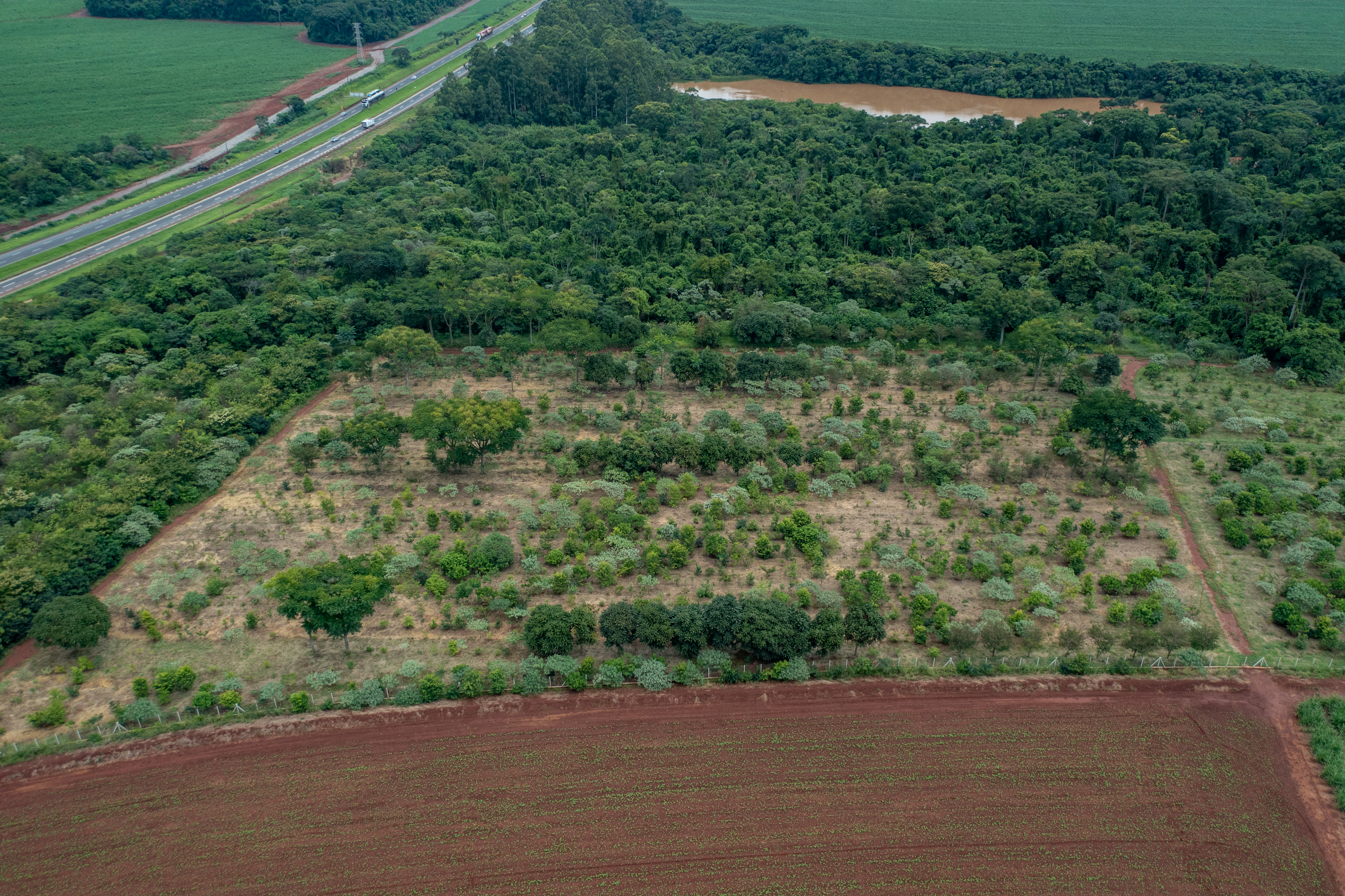

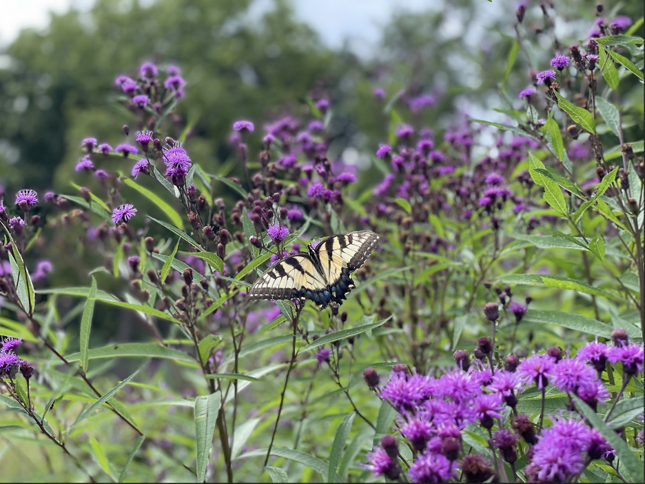

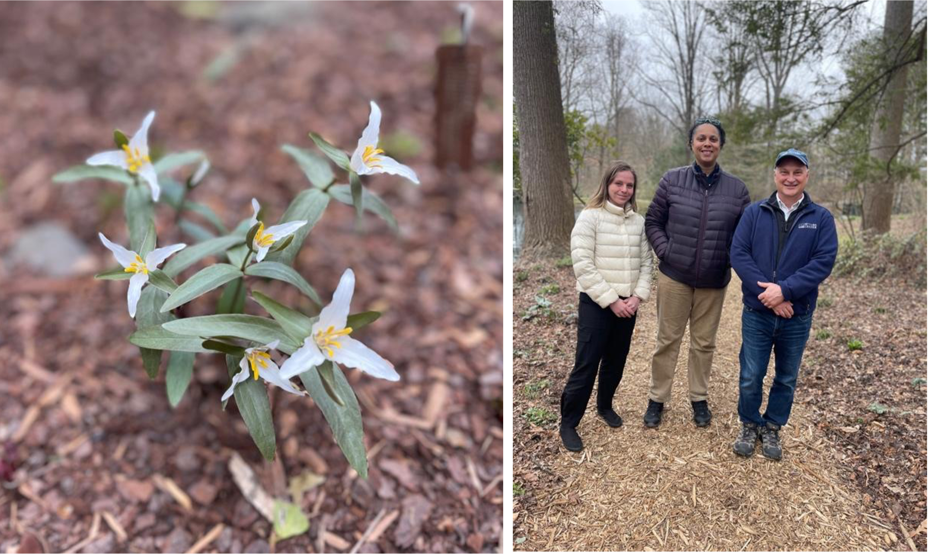


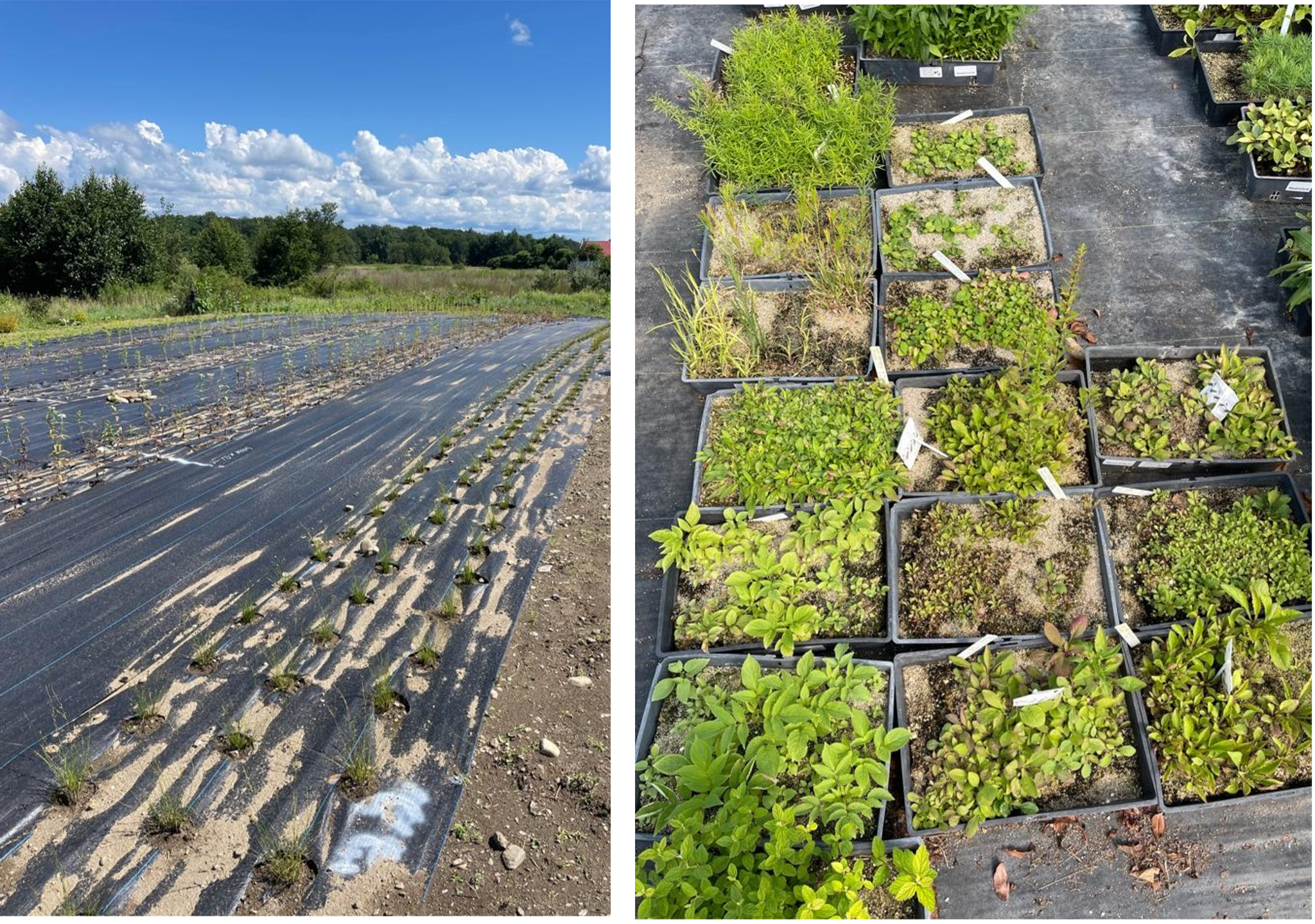


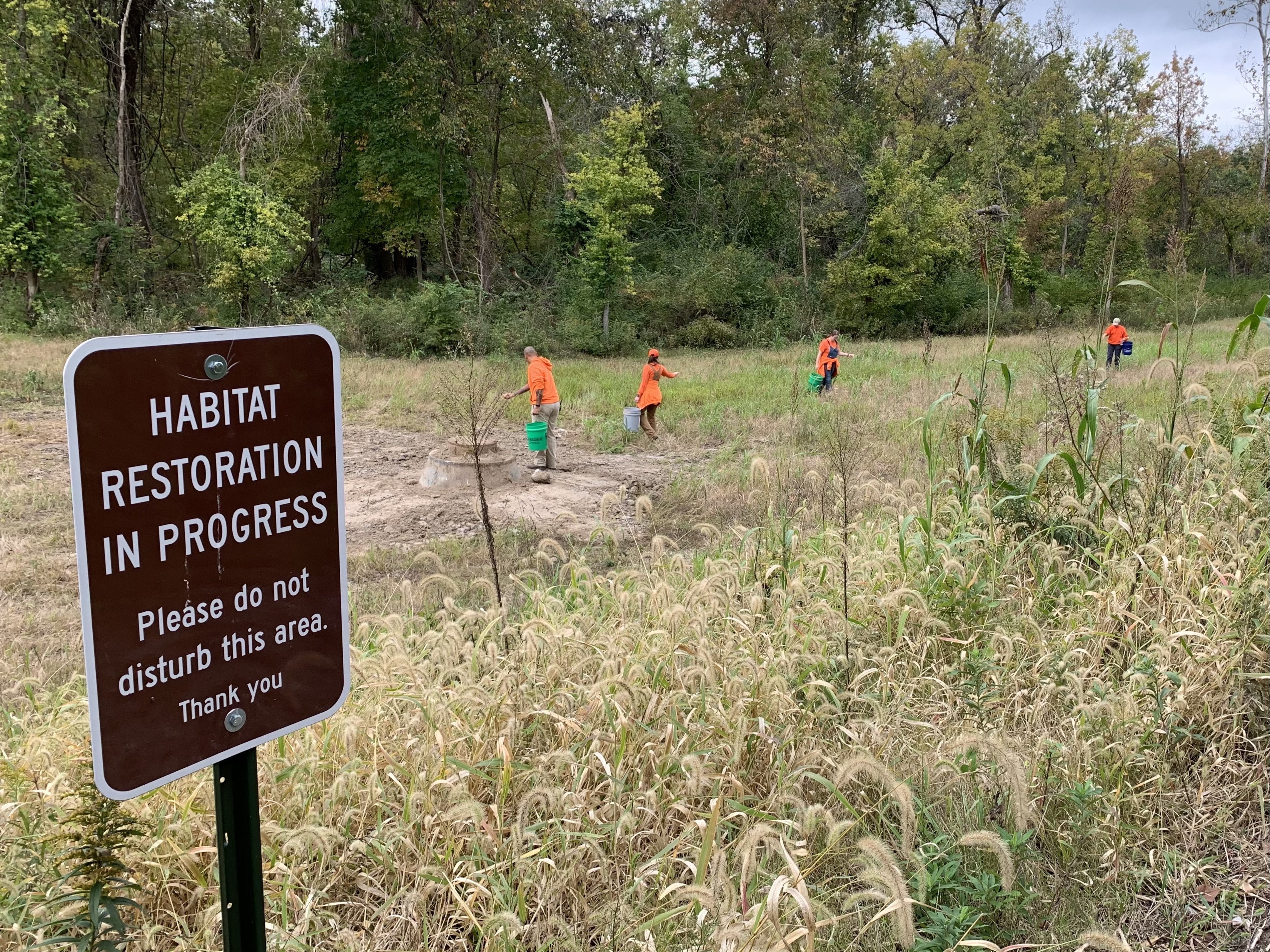


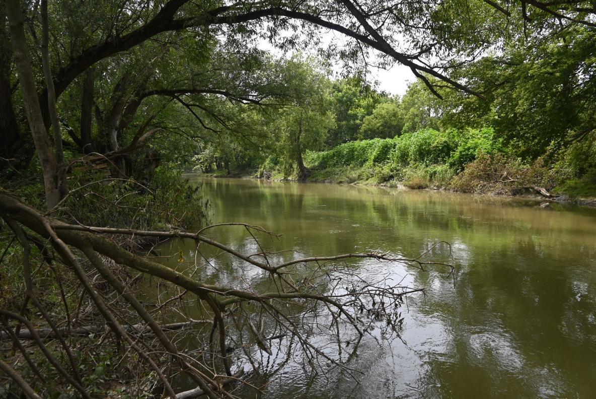
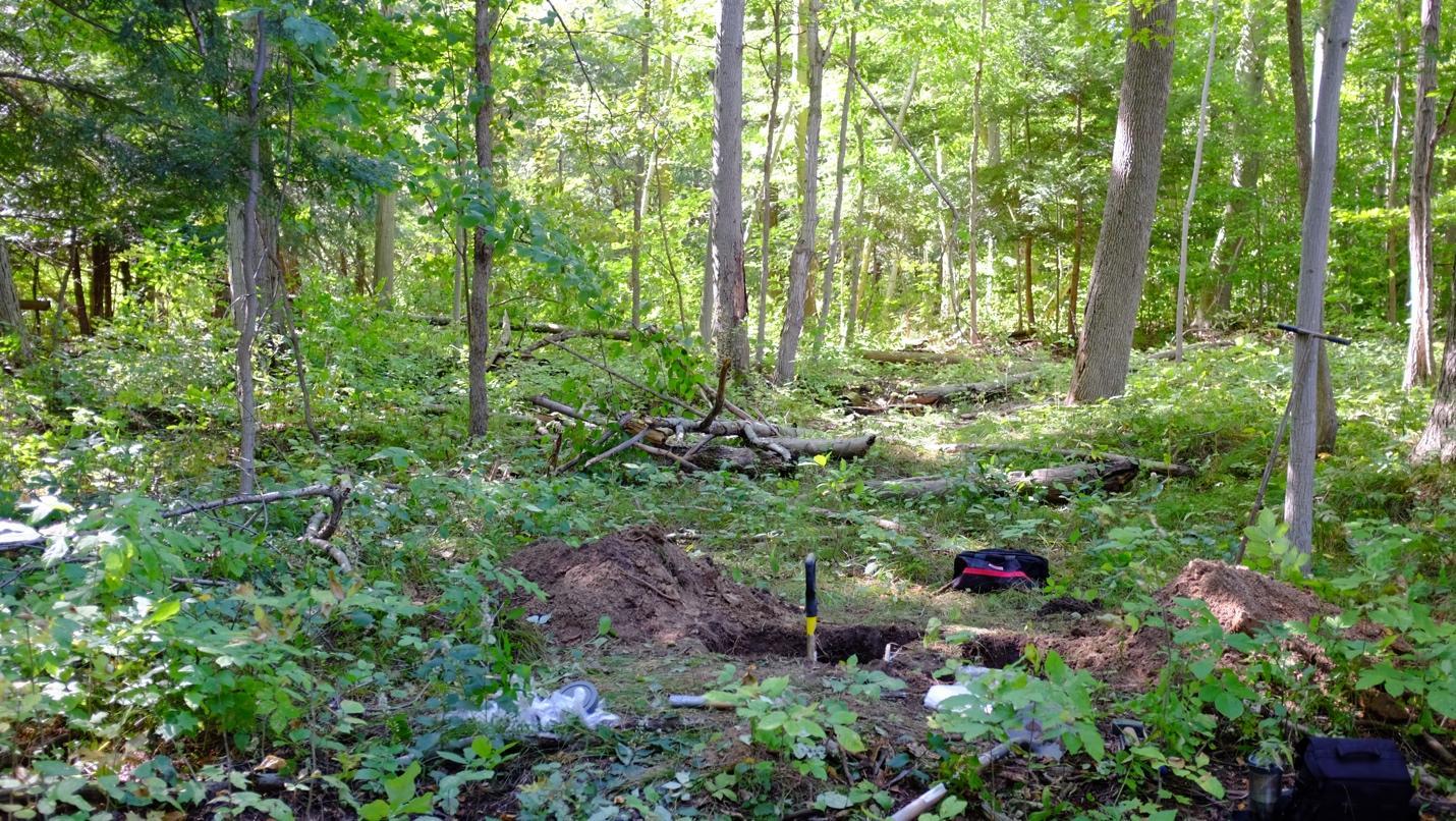 Soil pit in uncultivated Carolinian forest soil, Sunnivue Farm, 2021. Photo: Ed Gregorich.