By Dr. Pedro Brancalion

Dr. Brancalion is an associate professor of tropical forestry in the Department of Forest Sciences at the Luiz de Queiroz College of Agriculture (ESALQ) of the University of São Paulo. A leading expert in tropical forest restoration, Dr. Brancalion coordinates the Laboratory of Tropical Forestry (LASTROP), is partner at Re.green – a restoration company, is the Director of Innovation of the Center for Carbon Research in Tropical Agriculture, and member of the coordination board of the Center of Studies Sustainable Amazon.
Forest Landscape Restoration (FLR) emerged as a promising approach to revitalize degraded and deforested landscapes, by recovering their biodiversity, ecosystem services, and economic value. The Bonn Challenge is a pivotal FLR initiative, with an overarching goal of restoring 350 million hectares of degraded land by 2030. Over 210 million hectares have been pledged so far, by more than 60 nations, mostly across the tropics. Given its importance for mitigating some of the most pressing environmental crises of our time, like climate change and the sixth mass extinction, the Bonn Challenge and other FLR initiatives are strongly connected to other environmental and restoration programs, such as the Paris Climate Agreement, the United Nations’ Decade on Ecosystem Restoration and the UN Sustainable Development Goals. In spite of great promises and expectations, the implementation of these pledges has lagged behind schedule, highlighting the need to better engage local people by promoting FLR approaches that maximize desired benefits and overcome critical barriers for implementation.
FLR can be implemented through several reforestation approaches, including natural forest re-growth, mixed plantations of native species, monoculture tree plantations, and agroforestry. Planning the distribution of these approaches over space and time is a critical step towards effective FLR, and it depends on local socioecological conditions, targeted benefits, and stakeholders’ perceptions of the potential of each FLR approach to deliver these expected benefits. The aim of FLR is to establish multipurpose landscapes, where different FLR approaches are implemented in different areas to maximize various benefits.
FLR relies on the increase in landscape heterogeneity for recovering multiple environmental benefits. However, nearly half of the FLR pledges to the Bonn Challenge are composed of monoculture tree plantations, which maximize financial returns in the short term but undermine the optimal recovery of biodiversity and ecosystem services. Rather than promoting landscape heterogeneity, some of these FLR initiatives may have promoted the opposite process, a form of forest landscape degradation that may magnify the impacts of climate change and the biodiversity crisis. A critical step to shift the direction is to better understand the pros and cons of different FLR approaches for delivering contributions for nature and people.
The NewFor Project
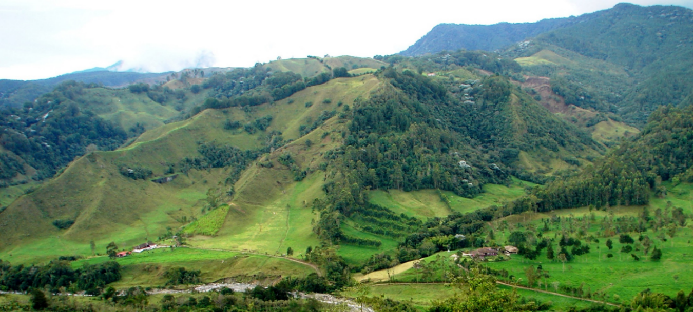
The Atlantic Forest of Brazil is a top global hotspot for the restoration of tropical rainforest landscapes. Since mid-2010’s, there has been a net increase in native forest cover and a fast expansion of eucalypt plantations, indicating that his region is rapidly transitioning to a mosaic of agricultural, forest, and urban landscapes. However, rather than the old-growth native forest remnants that once covered the region before deforestation, the new forest cover is now composed of a heterogeneous mosaic of different tree cover types. My colleagues and I believe it is important to understand how different tree cover types in different socioecological contexts influence human wellbeing and conservation. Doing so will allow us to develop new landscape-scale rules of thumb for FLR and will inform a menu of FLR options available to restoration practitioners to help them achieve their goals. At the same time, it would allow us to decipher some guidelines for restoration practice and offer a more robust menu of options for restoration practitioners to select the restoration approaches that better match their restoration conditions and expected benefits.
With these premises in mind, the project “Understanding restored forest benefits for nature and people – NewFor” was established initially as a partnership between the University of São Paulo (Brazil) and Wageningen University and Research (The Netherlands), financially supported by the São Paulo Research Foundation (FAPESP) and the Dutch Research Council (NWO). However, what was initially established as a research project between two universities rapidly transformed into a broad network of research organizations, NGOs (10), private companies (13), governmental agencies (5), and farms (over 50), which greatly increased the financial and logistical support of the project and allowed us to scale up our FLR project evaluations. These organizations have actively collaborated in the co-production of knowledge with researchers, an essential step towards more effective and transformative restoration.
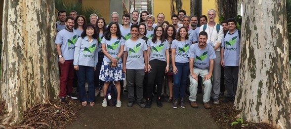
The NewFor team. Photo: Gehard Waller.
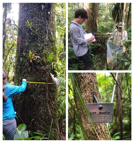
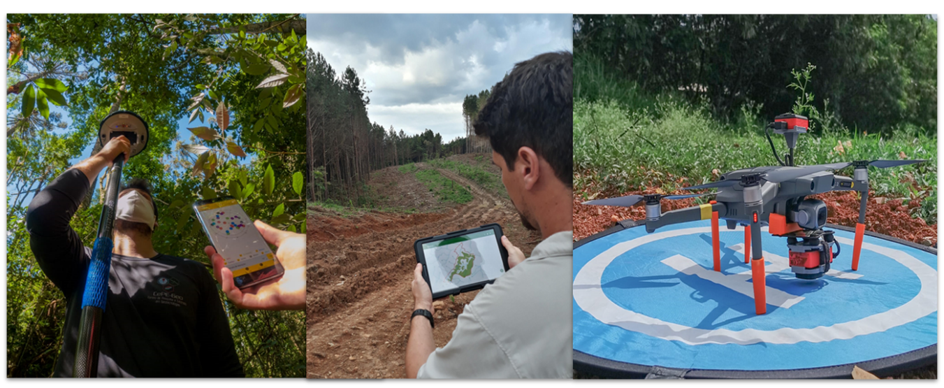
The NewFor Project was initiated in 2020 based on the application of a protocol for evaluating forest multifunctionality (soil carbon, chemical and physical evaluations, soil water infiltration, litter and dead wood stocks, forest inventory of trees with diameter at breast height ≥5 cm, counting of regenerating individuals with height ≥2 m and diameter <5 cm, in 30 x 30 m plots) in different tree cover types (natural forest re-growth, mixed species restoration plantations, monoculture tree plantations, agroforests, forest remnants and agropastoral land uses as a control) distributed across a broad range of age and biophysical conditions (soil and climate types, relief, neighboring land uses, landscape connectivity). Further, the field plots were integrated into remote sensing evaluations based on lidar and hyperspectral sensors carried on drones and airplanes. The study area is the state of São Paulo, in southeastern Brazil, where most of the biophysical gradients of interest were present and restoration projects abound.
The NewFor Project has been implemented through the following step:
- identification of a local partner who knows the region and can help identify and access different types of tree cover;
- evaluation of aerial and satellite images to create land use/cover maps, which are validated with a local partner and further used to randomly allocate the position of the field plot;
- field checking of the land use/cover, allocation of the permanent plots in the field with plastic tubes at the corners and high-precision geolocation;
- implementation of the protocol, tagging each tree with a metallic tag;
- flights over the field plot and the polygon with the tree cover type where the plot is located;
- processing of the samples in laboratory; and
- organization, storage, and validation of the data and metadata.
So far, the project accumulated data for more than 700 plots, which includes nearly 1,200 tree species, ~80,000 stems and ~50,000 trees, and obtained lidar data for ~400,000 hectares.
Field work by the NewFor team. Photos: Pedro Brancalion
Although few results of the project have been published in the literature so far, the bulk of data analysis, publications, and policy recommendations are about to start, as data collection has finished, and the dataset is ready to use. One of the most immediate – and perhaps most important – impacts of the NewFor Project was the inspiration for creating a similar nation-wide initiative by the Ministry of Science, Technology and Innovation, the Regenera Brasil initiative, which will employ a similar monitoring approach across all Brazilian regions and vegetation types, with the support of local research and outreach organizations. The Regenera Brasil project is about to start, which may make Brazil the first country to have a national restoration inventory.
To learn more about the NewFor Project, visit our blog and read our scientific papers about distinguishing between different FLR-related tree cover types and monitoring the outcomes of FLR interventions using UAV-based remote sensing, or contact the author. Also, follow us in social media: Instagram, YouTube, LinkedIn, and Facebook.
For additional information, contact Pedro Brancalion: pedrob@usp.br
